TED日本語
TED Talks(英語 日本語字幕付き動画)
TED日本語 - ジェフ・スペック: 都市を歩きやすくするための4つの方法
TED Talks
都市を歩きやすくするための4つの方法
4 ways to make a city more walkable
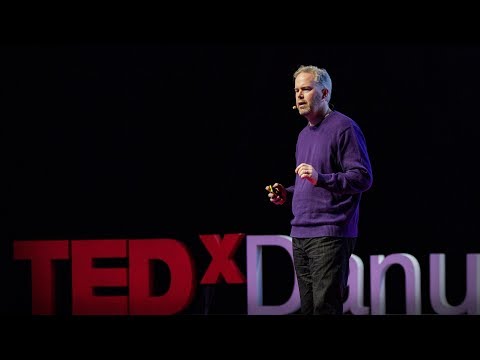
ジェフ・スペック
Jeff Speck
内容
自動車からの解放と都市のスプロール化(無秩序な拡大)からの解放、自分の町を歩き回る自由を!シティプランナーのジェフ・スペックが、6車線の幹線道路や200メートルの区画ブロックが無秩序に広がる都市を、自転車レーンや街路樹が並ぶ通りでできた安全で歩きやすいオアシスに変身させるための4つの原則「歩きやすさの一般論」を説明します。


字幕
SCRIPT
Script

So I'm here to talk to you about the walkable city. What is the walkable city? Well, for want of a better definition, it's a city in which the car is an optional instrument of freedom, rather than a prosthetic device. And I'd like to talk about why we need the walkable city, and I'd like to talk about how to do the walkable city.
Most of the talks I give these days are about why we need it, but you guys are smart. And also I gave that talk exactly a month ago, and you can see it at TED.com. So today I want to talk about how to do it. In a lot of time thinking about this, I've come up with what I call the general theory of walkability. A bit of a pretentious term, it's a little tongue-in-cheek, but it's something I've thought about for a long time, and I'd like to share what I think I've figured out.
In the American city, the typical American city -- the typical American city is not Washington, DC, or New York, or San Francisco; it's Grand Rapids or Cedar Rapids or Memphis -- in the typical American city in which most people own cars and the temptation is to drive them all the time, if you're going to get them to walk, then you have to offer a walk that's as good as a drive or better. What does that mean? It means you need to offer four things simultaneously: there needs to be a proper reason to walk, the walk has to be safe and feel safe, the walk has to be comfortable and the walk has to be interesting. You need to do all four of these things simultaneously, and that's the structure of my talk today, to take you through each of those.
The reason to walk is a story I learned from my mentors, Andres Duany and Elizabeth Plater-Zyberk, the founders of the New Urbanism movement. And I should say half the slides and half of my talk today I learned from them. It's the story of planning, the story of the formation of the planning profession. When in the 19th century people were choking from the soot of the dark, satanic mills, the planners said, hey, let's move the housing away from the mills. And lifespans increased immediately, dramatically, and we like to say the planners have been trying to repeat that experience ever since.
So there's the onset of what we call Euclidean zoning, the separation of the landscape into large areas of single use. And typically when I arrive in a city to do a plan, a plan like this already awaits me on the property that I'm looking at. And all a plan like this guarantees is that you will not have a walkable city, because nothing is located near anything else. The alternative, of course, is our most walkable city, and I like to say, you know, this is a Rothko, and this is a Seurat. It's just a different way -- he was the pointilist -- it's a different way of making places. And even this map of Manhattan is a bit misleading because the red color is uses that are mixed vertically.
So this is the big story of the New Urbanists -- to acknowledge that there are only two ways that have been tested by the thousands to build communities, in the world and throughout history. One is the traditional neighborhood. You see here several neighborhoods of Newburyport, Massachusetts, which is defined as being compact and being diverse -- places to live, work, shop, recreate, get educated -- all within walking distance. And it's defined as being walkable. There are lots of small streets. Each one is comfortable to walk on. And we contrast that to the other way, an invention that happened after the Second World War, suburban sprawl, clearly not compact, clearly not diverse, and it's not walkable, because so few of the streets connect, that those streets that do connect become overburdened, and you wouldn't let your kid out on them. And I want to thank Alex Maclean, the aerial photographer, for many of these beautiful pictures that I'm showing you today.
So it's fun to break sprawl down into its constituent parts. It's so easy to understand, the places where you only live, the places where you only work, the places where you only shop, and our super-sized public institutions. Schools get bigger and bigger, and therefore, further and further from each other. And the ratio of the size of the parking lot to the size of the school tells you all you need to know, which is that no child has ever walked to this school, no child will ever walk to this school. The seniors and juniors are driving the freshmen and the sophomores, and of course we have the crash statistics to prove it.
And then the super-sizing of our other civic institutions like playing fields -- it's wonderful that Westin in the Ft. Lauderdale area has eight soccer fields and eight baseball diamonds and 20 tennis courts, but look at the road that takes you to that location, and would you let your child bike on it? And this is why we have the soccer mom now. When I was young, I had one soccer field,one baseball diamond and one tennis court, but I could walk to it, because it was in my neighborhood.
Then the final part of sprawl that everyone forgot to count: if you're going to separate everything from everything else and reconnect it only with automotive infrastructure, then this is what your landscape begins to look like. The main message here is: if you want to have a walkable city, you can't start with the sprawl model. you need the bones of an urban model. This is the outcome of that form of design, as is this. And this is something that a lot of Americans want. But we have to understand it's a two-part American dream. If you're dreaming for this, you're also going to be dreaming of this, often to absurd extremes, when we build our landscape to accommodate cars first. And the experience of being in these places --
(Laughter)
This is not Photoshopped. Walter Kulash took this slide. It's in Panama City. This is a real place. And being a driver can be a bit of a nuisance, and being a pedestrian can be a bit of a nuisance in these places. This is a slide that epidemiologists have been showing for some time now,
(Laughter)
The fact that we have a society where you drive to the parking lot to take the escalator to the treadmill shows that we're doing something wrong. But we know how to do it better.
Here are the two models contrasted. I show this slide, which has been a formative document of the New Urbanism now for almost 30 years, to show that sprawl and the traditional neighborhood contain the same things. It's just how big are they, how close are they to each other, how are they interspersed together and do you have a street network, rather than a cul-de-sac or a collector system of streets?
So when we look at a downtown area, at a place that has a hope of being walkable, and mostly that's our downtowns in America's cities and towns and villages, we look at them and say we want the proper balance of uses. So what is missing or underrepresented? And again, in the typical American cities in which most Americans live, it is housing that is lacking. The jobs-to-housing balance is off. And you find that when you bring housing back, these other things start to come back too, and housing is usually first among those things. And, of course, the thing that shows up last and eventually is the schools, because the people have to move in, the young pioneers have to move in, get older, have kids and fight, and then the schools get pretty good eventually.
The other part of this part, the useful city part, is transit, and you can have a perfectly walkable neighborhood without it. But perfectly walkable cities require transit, because if you don't have access to the whole city as a pedestrian, then you get a car, and if you get a car, the city begins to reshape itself around your needs, and the streets get wider and the parking lots get bigger and you no longer have a walkable city. So transit is essential. But every transit experience, every transit trip, begins or ends as a walk, and so we have to remember to build walkability around our transit stations.
Next category, the biggest one, is the safe walk. It's what most walkability experts talk about. It is essential, but alone not enough to get people to walk. And there are so many moving parts that add up to a walkable city.
The first is block size. This is Portland, Oregon, famously 200-foot blocks, famously walkable. This is Salt Lake City, famously 600-foot blocks, famously unwalkable. If you look at the two, it's almost like two different planets, but these places were both built by humans and in fact, the story is that when you have a 200-foot block city, you can have a two-lane city, or a two-to-four lane city, and a 600-foot block city is a six-lane city, and that's a problem. These are the crash statistics. When you double the block size -- this was a study of 24 California cities -- when you double the block size, you almost quadruple the number of fatal accidents on non-highway streets.
So how many lanes do we have? This is where I'm going to tell you what I tell every audience I meet, which is to remind you about induced demand. Induced demand applies both to highways and to city streets. And induced demand tells us that when we widen the streets to accept the congestion that we're anticipating, or the additional trips that we're anticipating in congested systems, it is principally that congestion that is constraining demand, and so that the widening comes, and there are all of these latent trips that are ready to happen. People move further from work and make other choices about when they commute, and those lanes fill up very quickly with traffic, so we widen the street again, and they fill up again. And we've learned that in congested systems, we can not satisfy the automobile.
This is from Newsweek Magazine -- hardly an esoteric publication: "Today's engineers acknowledge that building new roads usually makes traffic worse." My response to reading this was, may I please meet some of these engineers, because these are not the ones that I -- there are great exceptions that I'm working with now -- but these are not the engineers one typically meets working in a city, where they say, "Oh, that road is too crowded, we need to add a lane." So you add a lane, and the traffic comes, and they say, "See, I told you we needed that lane." This applies both to highways and to city streets if they're congested.
But the amazing thing about most American cities that I work in, the more typical cities, is that they have a lot of streets that are actually oversized for the congestion they're currently experiencing. This was the case in Oklahoma City, when the mayor came running to me, very upset, because they were named in Prevention Magazine the worst city for pedestrians in the entire country. Now that can't possibly be true, but it certainly is enough to make a mayor do something about it. We did a walkability study, and what we found, looking at the car counts on the street -- these are 3,000-,4,000-,7, 000-car counts and we know that two lanes can handle 10,000 cars per day. Look at these numbers -- they're all near or under 10,000 cars, and these were the streets that were designated in the new downtown plan to be four lanes to six lanes wide. So you had a fundamental disconnect between the number of lanes and the number of cars that wanted to use them.
So it was my job to redesign every street in the downtown from curb face to curb face, and we did it for 50 blocks of streets, and we're rebuilding it now. So a typical oversized street to nowhere is being narrowed, and now under construction, and the project is half done. The typical street like this, you know, when you do that, you find room for medians. You find room for bike lanes. We've doubled the amount of on-street parking. We've added a full bike network where one didn't exist before.
But not everyone has the money that Oklahoma City has, because they have an extraction economy that's doing quite well. The typical city is more like Cedar Rapids, where they have an all four-lane system, half one-way system. And it's a little hard to see, but what we've done -- what we're doing; it's in process right now, it's in engineering right now -- is turning an all four-lane system, half one-way into an all two-lane system, all two-way, and in so doing, we're adding 70 percent more on-street parking, which the merchants love, and it protects the sidewalk. That parking makes the sidewalk safe, and we're adding a much more robust bicycle network.
Then the lanes themselves. How wide are they? That's really important. The standards have changed such that, as Andres Duany says, the typical road to a subdivision in America allows you to see the curvature of the Earth.
(Laughter)
This is a subdivision outside of Washington from the 1960s. Look very carefully at the width of the streets. This is a subdivision from the 1980s. 1960s, 1980s. The standards have changed to such a degree that my old neighborhood of South Beach, when it was time to fix the street that wasn't draining properly, they had to widen it and take away half our sidewalk, because the standards were wider. People go faster on wider streets. People know this. The engineers deny it, but the citizens know it, so that in Birmingham, Michigan, they fight for narrower streets. Portland, Oregon, famously walkable, instituted its "Skinny Streets" program in its residential neighborhood. We know that skinny streets are safer. The developer Vince Graham, in his project I'On, which we worked on in South Carolina, he goes to conferences and he shows his amazing 22-foot roads. These are two-way roads, very narrow rights of way, and he shows this well-known philosopher, who said, "Broad is the road that leads to destruction ... narrow is the road that leads to life."
(Laughter)
(Applause)
This plays very well in the South.
Now: bicycles. Bicycles and bicycling are the current revolution underway in only some American cities. But where you build it, they come. As a planner, I hate to say that, but the one thing I can say is that bicycle population is a function of bicycle infrastructure. I asked my friend Tom Brennan from Nelson\Nygaard in Portland to send me some pictures of the Portland bike commute. He sent me this. I said, "Was that bike to work day?" He said, "No, that was Tuesday." When you do what Portland did and spend money on bicycle infrastructure -- New York City has doubled the number of bikers in it several times now by painting these bright green lanes. Even automotive cities like Long Beach, California: vast uptick in the number of bikers based on the infrastructure. And of course, what really does it, if you know 15th Street here in Washington, DC -- please meet Rahm Emanuel's new bike lanes in Chicago, the buffered lane, the parallel parking pulled off the curb, the bikes between the parked cars and the curb -- these mint cyclists. If, however, as in Pasadena, every lane is a bike lane, then no lane is a bike lane. And this is the only bicyclist that I met in Pasadena, so ...
(Laughter)
The parallel parking I mentioned -- it's an essential barrier of steel that protects the curb and pedestrians from moving vehicles. This is Ft. Lauderdale; one side of the street, you can park, the other side of the street, you can't. This is happy hour on the parking side. This is sad hour on the other side. And then the trees themselves slow cars down. They move slower when trees are next to the road, and, of course, sometimes they slow down very quickly. All the little details -- the curb return radius. Is it one foot or is it 40 feet? How swoopy is that curb to determine how fast the car goes and how much room you have to cross. And then I love this, because this is objective journalism. "Some say the entrance to CityCenter is not inviting to pedestrians." When every aspect of the landscape is swoopy, is aerodynamic, is stream-form geometrics, it says: "This is a vehicular place." So no one detail, no one speciality, can be allowed to set the stage. And here, you know, this street: yes, it will drain within a minute of the hundred-year storm, but this poor woman has to mount the curb every day.
So then quickly, the comfortable walk has to do with the fact that all animals seek, simultaneously, prospect and refuge. We want to be able to see our predators, but we also want to feel that our flanks are covered. And so we're drawn to places that have good edges, and if you don't supply the edges, people won't want to be there. What's the proper ratio of height to width? Is it one to one? Three to one? If you get beyond one to six, you're not very comfortable anymore. You don't feel enclosed. Now,six to one in Salzburg can be perfectly delightful. The opposite of Salzburg is Houston. The point being the parking lot is the principal problem here. However, missing teeth, those empty lots can be issues as well, and if you have a missing corner because of an outdated zoning code, then you could have a missing nose in your neighborhood. That's what we had in my neighborhood. This was the zoning code that said I couldn't build on that site. As you may know, Washington, DC is now changing its zoning to allow sites like this to become sites like this. We needed a lot of variances to do that. Triangular houses can be interesting to build, but if you get one built, people generally like it. So you've got to fill those missing noses.
And then, finally, the interesting walk: signs of humanity. We are among the social primates. Nothing interests us more than other people. We want signs of people. So the perfect one-to-one ratio, it's a great thing. This is Grand Rapids, a very walkable city, but nobody walks on this street that connects the two best hotels together, because if on the left, you have an exposed parking deck, and on the right, you have a conference facility that was apparently designed in admiration for that parking deck, then you don't attract that many people. Mayor Joe Riley, in his 10th term, Mayor of Charleston, South Carolina, taught us it only takes 25 feet of building to hide 250 feet of garage. This one I call the Chia Pet Garage. It's in South Beach. That active ground floor.
I want to end with this project that I love to show. It's by Meleca Architects. It's in Columbus, Ohio. To the left is the convention center neighborhood, full of pedestrians. To the right is the Short North neighborhood -- ethnic, great restaurants, great shops, struggling. It wasn't doing very well because this was the bridge, and no one was walking from the convention center into that neighborhood. Well, when they rebuilt the highway, they added an extra 80 feet to the bridge. Sorry -- they rebuilt the bridge over the highway. The city paid 1.9 million dollars, they gave the site to a developer, the developer built this and now the Short North has come back to life. And everyone says, the newspapers, not the planning magazines, the newspapers say it's because of that bridge.
So that's it. That's the general theory of walkability. Think about your own cities. Think about how you can apply it. You've got to do all four things at once. So find those places where you have most of them and fix what you can, fix what still needs fixing in those places.
I really appreciate your attention, and thank you for coming today.
(Applause)
歩きやすい都市について お話ししたいと思います 歩きやすい都市とは何でしょうか? より分かりやすく定義すると 自動車が必要不可欠というより 選択肢の1つであるような 都市のことです そこで 歩きやすい都市の 必要性について説明し その実現方法について お話ししたいと思います
最近お話ししているのはほとんどが その必要性についてですが 皆さんは もうご存知のことでしょうし ちょうど1か月前に行ったトークを TED.comでご覧になれますから 今日はその実現方法について お話しします この事を考え続けて 歩きやすさについての 一般論を思いつきました 口幅ったい言い方ですし 少々もったいぶった感じですが 私が長い間温めてきて 理解したことを紹介したいと思います
アメリカの都市は ― 典型的な都市ということですが ワシントンD.C.でもなく ニューヨークでも サンフランシスコでもありません グランドラピッズやセダーラピッズや メンフィスといった都市です この典型的なアメリカの都市では ほとんどの人が車を持ち 常に車に乗っていたい と思うものです ですから そこで歩いてもらうには 歩くことが運転と同じくらい 魅力的だと思ってもらう必要があります これはどういうことでしょう? 4点セットを同時に 提供する必要があるということです 歩く理由 安全・安心感があること 快適に歩けること 楽しいことです この4つが同時に必要です これが本日のトークの柱です それぞれ お話ししていきますね
私はメンターたちから 歩く理由を学びました アンドレス・デュアニーと エリザベス・プラター・ザイバーグで ニューアーバニズム運動の創始者です 本日の内容の半分は この2人から学んだことです これは都市計画の話 職業としてのシティプランナーの 成立についてです 19世紀の人々はおぞましい工場から 排出される真っ黒なすすに 悩まされていました そこで プランナーは住居と工場を 引き離せばいいと考え するとほどなく人々の寿命が 劇的に向上しました それ以来プランナーは この体験を再現しようとしてきたと言っても 過言ではないでしょう
私たちがユークリッド・ゾーニングと 呼んでいるものが始まり 土地を単一目的の 広大な敷地に分断していきました 私が都市計画を行うため 現地に到着すると 土地がこういったデザインに なっていることが多いのですが こうした計画では 間違いなく 歩きやすい都市にはならないでしょう 何も近くにないからです その代わりに ― ご存知の 最も歩きやすい都市 マンハッタンです 先ほどの地図はロスコーの絵のようですが こちらは点描画家の スーラの絵のようです それぞれの手法で街が作られていますね このマンハッタンの地図も 少し紛らわしいですね 赤色が一面に塗られていますから
これはニューアーバニストの壮大な物語 ― コミュニティを構築するため 歴史を通じて世界中で 何千回も試されてきた方法は 2通りだという話です そのひとつがこんな伝統的な界隈です これは マサチューセッツ州 ニューベリーポートの界隈です コンパクトで多様性に満ちていて 住居や職場、店舗や 娯楽施設、学校は 徒歩圏内にあり 歩きやすいように街が設計されています 細い通りがいくつもあって どれも歩きやすい道です この対照例として挙げるのは 第二次世界大戦後に起こった 郊外地域の スプロール化(無秩序な拡大)です どう見てもコンパクトではなく 多様性に欠け 歩きづらい つながっている通りが少なく つながった通りは渋滞し 子どもを歩かせられるような 道ではありません 航空写真家のアレックス・マクリーンが 本日お見せする 美しい航空写真を数多く 提供してくれました
スプロール化した都市の パーツを見てみるのは面白いですよ 見分けるのは非常に簡単です 住むだけのための場所 働くためだけの場所 買い物のためだけの場所 巨大な公共施設 学校はどんどん大きくなり ますますお互いから 離れていくようになります 駐車場と学校の建物の 大きさの比率を見ると 徒歩で登校できない ということは一目瞭然です 歩いて登校している子 などいないでしょう 上級生が下級生を 自動車に乗せ登校するので それが交通事故の統計に表れます
そして巨大化した公共施設 運動場などですが フォートローダーデール地区の ウェスティンには サッカー場が8面、野球場が8面 テニスコートが20面もありますが そこへ続く道路に注目してください 子どもを自転車で 行かせたりしますか? 車で送迎する サッカーマムが必要なわけです 私が子供の頃はサッカー場と野球場と テニスコートが1面ずつだけでしたが 私は歩いていくことができました 近所にあったからです
つい忘れがちなスプロールの最終段階は 何もかもお互いから離してしまって それらを自動車道路だけでつなげると このような風景に なってしまうということです ここでいちばん言いたいことは 歩きやすい都市にしたければ スプロールモデルは使えないことです 都市モデルには 骨格が必要です これがその通りに設計した結果です このとおりです これがアメリカ人の多くが 望むものなのです しかしアメリカンドリームには 2つの面があります もし これを夢見て 自動車優先の風景を作り上げると その夢は馬鹿げた極端な風景を 生み出すことが多いのです こういう場所に行ってみると [この信号は青になりません]
(笑)
画像の加工はしていませんよ ウォルター・クラシュが このスライドを撮りました これは パナマシティにある 実在する場所です スムーズな運転は難しく 歩くのもなかなか厄介です こんなところではね 次は疫学研究でよく目にするスライドですが
(笑)
私たちの社会では スポーツジムまで車で行き 入り口にはエスカレーター 何かが間違っています でも 改善策は分かっています
対照的なモデルが2つあります 30年ぐらい ニューアーバニズムの教科書的なものだった このスライドをお見せします スプロールと伝統的な界隈は 色分けされた 同じ建物要素を含んでいることがわかります その違いは大きさと お互いの距離 分散の仕方であり 袋小路よりも 道路のネットワークが多いか 通りが密集しているかの違いです
あるダウンタウンの地域を もっと歩きやすい地域へと 改善することを考えるとき アメリカの都市や 町や村の 大部分のダウンタウンにあてはまりますが 用途のバランスを適正にしましょうという 話を始めます 欠けたり不足しているのものは 何でしょうか? アメリカ人の大部分が住んでいる 典型的な都市部では 不足しているのは住宅であり 職と住のバランスが偏っています 住居を取り戻してやると 他の建物も戻ってきますので まず住居の配置ありきなのです そしてもちろん 最終的には 学校が戻ってきます それは人が引っ越してくると 若者が成長して子供を持つようになり 競争が起きて 学校がよくなっていきます
そしてその他の部分について 都市部の便利さ 公共交通機関です なくても完璧に歩きやすい地域の整備は できますが 都市を完璧に歩きやすくするためには 交通機関が必要です 歩行者として町全体にアクセスできないと 自動車に乗ることになり そして 自動車が増えると 都市はそのニーズに応じて 再び形を変え 道路が広くなり 駐車場が広がり もはや歩きやすい都市ではなくなります 交通機関は不可欠です どんな交通機関を使うにしても 最初と最後は徒歩です ですから駅の周囲を 歩きやすくする必要があります
次のカテゴリーは一番大切で 安全に歩けることです これが歩きやすさには不可欠ですが それだけでは十分ではありません 歩きやすい都市をつくる 多くの要素があります
まずは1ブロックの大きさです こちらはオレゴン州ポートランドで 1ブロックが60メートルで 歩きやすいことで有名です こちらはソルトレークシティです 1ブロックが200メートルあって 歩きにくいことで知られています 比べてみると まるで別の惑星のようですが どちらも人類が作った場所です ブロックが60メートルの都市ならば 2車線あるいは 2車線から4車線の都市になります ブロックが200メートルの都市は 6車線でこれは問題です 交通事故の統計によると ブロックサイズが倍になると カリフォルニアの 24都市での研究ですが ― ブロックサイズが倍になると 一般道における死亡事故が 約4倍になります
では 何車線がいいのでしょうか? ここからは講演のたびに お話しすることなんですが 「需要が誘発されること」について 考えてもらうことにしています 「誘発需要」現象は幹線道路にも 一般道にも当てはまります 誘発された需要から分かるのは 予期される交通渋滞に対応するために 道路を広げたり 渋滞のために迂回するといった ことを予測する 混雑に対応するシステム自体が 需要を刺激しており 道路が拡大されるようになり それにつれてまた新たに迂回が起こります 人々は更に職場から遠ざかり 通勤時間帯を変えたりして これらの車道が 瞬く間に渋滞するようになり 再び道路を広げれば また満杯になります これが渋滞した システムから学んだことです 自動車を優先した都市作りは不可能です
ニューズウィーク誌からです 深遠な記事などみかけない雑誌ですが 「こんにちエンジニアは 新たな道路の建設で 交通渋滞が悪化すると認めている」 これを読んで私は 「このエンジニアに会いたい」と思いました ただのエンジニアではないなと思ったのです 私が実際知っている 素晴らしい技術者は例外で 都市計画でお目にかかる ごく一般的なエンジニアは 「交通渋滞するから 車線を増やそう」 と考えるものです 車線を増やすと渋滞するようになり 「ほら 車線が必要だったでしょ」と 言うようなね これは幹線道路や一般道 どちらの渋滞にもあてはまります
私が仕事をしている アメリカの都市については不思議なことに 典型的な都市の多くには 現在直面している渋滞に比べて 広すぎるような道路が多くあります オクラホマシティの例ですが 市長があわてて連絡をして来ました 「プリベンション」誌で 歩行者にとって最悪な町だと こき下ろされたからです そんなはずはありませんが 市長としては 何とかしなければなりません まず歩きやすさを調査しました 通行する自動車の数を数えて 分かったことは 3千、4千、7千台 だったのですが 2車線の場合は 1日1万台が通行できるはずで この数字を見ると どれも1万台未満ですね 新たなダウンタウン計画の一環として 4車線から6車線幅で 設計された道路でしたが 車線数とそれを必要とする 自動車の数との間に 根本的なずれがあったのです
こうして ダウンタウンの 全ての道路の再設計を任されました 縁石に至るまで全てを任されて 50ブロックについて設計しました 現在 再建設中です こんな典型的な無駄に広い道路は 幅を狭めるように 現在工事中です プロジェクトは半分完了しました 典型的なこんな道路が ― 適切な車線幅がわかり 自転車レーンが作れるようになります 路上の駐車スペースを2倍にしました 今まではなかった自転車ネットワークを 追加しました
でも 誰もがオクラホマシティのように お金持ちではありません ここは資源ビジネスが好調ですからね 多くの都市は セダーラピッズのように 4車線を基本にして 半分は一方通行です ちょっと見にくいですが 私たちがやっていること 今進めていることは 現在施工中なのですが 4車線が基本で 半分は一方通行というシステムを 2車線が基本で 対面通行のシステムに変えることで 路上の駐車スペースを70%増やしました 店舗は喜ぶでしょうし 安全な歩道も守れます 駐車場があることで歩道が安全になり しっかりとした 自転車ネットワークも加えました
では車線の幅はどうでしょうか? これは非常に重要です 規格は幅広くなり続け アンドレス・デュアニー いわく アメリカ郊外の典型的な道路では 地平線が見えるのだそうです
(笑)
この分譲地は 1960年代のワシントン郊外です 通りの幅をよく見てみてください これは 1980年代の分譲地です 1960年代、1980年代で 規格がこんなに変わっているのです これは私の古馴染みのサウスビーチですが 排水の補修工事を行う際に 道路を拡大し歩道を 半分にしてしまいました 基準規格が広がったからです でも広い道では誰もが急ぎます 誰もがそれを知っています エンジニアが否定しても 市民は知っていますから ミシガン州バーミンガムでは 細い道を勝ち取ろうとしています 歩きやすさで有名な オレゴン州ポートランドは 「スキニーストリート」プログラムを 住宅地で立ち上げました 細い道の方が 安全だとわかっています 開発業者のビンス・グラハムは サウスカロライナで手掛けている l'Onプロジェクトで 素晴らしい7メートル幅の 道路を公開しています 対面通行の非常に細い道です 彼はこの教えを 引き合いに出すのです 「広き道は滅びにつながり 狭き道は命につながる」 [マタイ伝7章13節]
(笑)
(拍手)
これはサウスカロライナでうまくいっています
さて 自転車ですが 自転車とサイクリングは アメリカの都市のごく一部で 革命を起こしつつあります 「それを作れば彼らは来る」わけです プランナーとしては言いにくいのですが サイクリスト人口は 自転車用インフラの関数です ポートランドで設計事務所をしている 友人トム・ブレナンに ポートランドの自転車通勤の写真を 依頼したら これを送ってくれました 「自転車通勤の日なの?」と聞くと 「いつもの様子だ」と言っていました ポートランドと同様に自転車の インフラに費用を費やすとどうなるか ニューヨーク市は レーンを明るい緑色に塗装して サイクリストの数を 数倍にしました カリフォルニア州ロングビーチのような 自動車都市ですら インフラ整備により サイクリストの数が増加しています そしてもちろん ワシントンDCの15番街はご存知でしょう シカゴ市長のラーム・エマニュエルによる 新しい自転車レーンですが 緩衝レーンや平行駐車された車が 縁石沿いに並び 駐車された車と縁石の間を走る サイクリスト達が新たに誕生しました パサデナのように全てのレーンで 自転車走行が許されていたら それは自転車道として機能しません これがパサデナで出会った 唯一のサイクリストでした
(笑)
私が述べた平行駐車は 縁石と歩行者を 自動車から守るための 不可欠な鉄の壁になります これはフォートローダーデールの 道路を車から撮影したものです こちら側は駐車できますが 反対側は駐車禁止です 駐車場側のハッピーアワーです これは反対側のサッドアワーですね この並木があることで 自動車が速度を落とします 並木道ではゆっくり走行しますから もちろん 急に減速させることもあります 細部についてですが ― 縁石の隅切り半径は 30センチでしょうか 1.2メートルでしょうか? この縁石をどこまで切るかで 自動車の速度に影響します 横断に必要な時間も決まります これは最高です 客観的なジャーナリズムの例 「シティセンターの入口は 歩行者に向いていないと言われる」 風景のあらゆる線が 曲線的で 空気力学的で 流線型に設計されている時 そこは自動車のための空間だ というようなものです いかなる特徴的なディテールも 自動車の妨げになり 受け入れられません ご覧ください この通りですが 百年に一度の嵐も またたく間に排水可能もしれませんが 気の毒なこの女性は この縁石を毎日登らなくてはなりません
また 快適な歩行には どんな生き物も見晴らしだけでなく 隠れ場所も必要だということです 襲ってくる捕食者を見つけると同時に 守られていると感じることも大切です それで私たちは 角のある場所に引き寄せられます 角が無い場所には人は集まりません では高さと幅の適切な割合は 何でしょうか? 1対1?3対1でしょうか? 1対6を超えてしまうと 落ち着かなくなります 囲まれている安心感がありません ザルツブルグにあるこの 6対1比なら快適でしょう その真逆はヒューストンです ここでは駐車場になっている場所が 主要な問題なのです このような「歯抜け」状態や 駐車場になっている空き地の問題同様に 時代遅れの土地計画規制のせいで 角がなくなると 界隈から「鼻」である三角地が 失われてしまうこともあります これはうちの界隈にあったものです これは建築禁止の地区規制です ワシントンDCは新たな地域地区計画のもとに この様な地区をこのように変えています 多様なバリエーションが必要でした 三角形の家を建てるのは楽しく 一度建ててみると おおむね好評でした これで失われた「鼻」が得られたわけです
そして最後に歩くことの楽しさについて これは人間性の現れですね 私たちは社会的な霊長類ですから 私たちにとって 他人ほど興味深いものはありません 人の姿が恋しいものです 完璧な1対1の割合だといいですね これは歩きやすい都市とされる グランドラピッズです でも 最高級のホテルをつなぐ この通りは誰も歩いていませんね 左手には立体駐車場があり 右手には会議施設があり 明らかに立体駐車場を鑑賞する為に 設計されていて 人を惹きつけてはいないようです サウスカロライナ州チャールストンの ジョー・ライリー市長は第10期で 8メートルの建物があれば 80メートルの駐車場を こうやって隠せることを示しました このチア・ペット・ガレージは サウスビーチにあります 生きている建物です
このプロジェクトで締めくくりたいと思います メレカ・アーキテクツによるもので オハイオ州コロンバスにあります 向かって左側に会議場があり 大勢の歩行者がいます 右側はショートノース地区で 多彩な文化がある地区 おいしいレストランや良い店があるのに 苦戦していました 上手くいかない理由は この橋のせいでした 会議場からこの地域に渡ってくる人が いなかったのです 幹線道路を再建したときに橋を 24メートル追加 ― 失礼 幹線道路の上に橋を再建したのです 市は190万ドルをかけて 開発業者に場所を提供し 開発業者がこれを建築して ショートノースが生き返りました そして都市計画の雑誌ではなく誰もが 新聞ですら これは橋のお陰だと言っています
以上が歩きやすさの一般論です ご自分の町を考えてみてください そしてどうやって適用していくか この4つの要素が同時に必要ですよ 要素の大半が揃っている場所を見つけて 可能な修復を加えて 必要な改善を施してください
ご清聴いただき そして お越しいただき ありがとうございました
(拍手)
品詞分類
- 主語
- 動詞
- 助動詞
- 準動詞
- 関係詞等
TED 日本語
TED Talks
関連動画

人類の未来を変革する10年 あるいは地球が不安定化する10年ヨハン・ロックストローム
2020.10.15ビッグデータと小規模農場と2つのトマトの物語エリン・バウムガートナー
2020.09.11屋内垂直農場が農業の未来なのか?スチュアート・オダ
2020.02.07新しい政治の物語はすべてを変えられるジョージ・モンビオ
2019.09.05一過性の都市に見る驚異の建築術ラフール・メロトラ
2019.08.29政治家をあるものに置き換える大胆な構想セザー・ヒダルゴ
2019.04.03気候のための行動への心開かれる訴え | TED Talkグレタ・サンバーグ
おすすめ 12019.02.13気候変動に対してあなたが出来るいちばん大事なことキャサリン・ヘイホー
2019.01.11何をやるときにも自分に問う3つの質問ステイシー・エイブラムス
2019.01.08子供たちに学ぶ都市計画マーラ・ミンツァー
2018.11.28テクノロジー企業があなたを欺いてデータとプライバシーを放棄させる手口フィン・リュツォー=ホルム・ミスタッド
2018.11.21街の東側に貧困地域が多いのはなぜかスティーブン・デベリー
2018.09.12無人操縦エアタクシーが移動方法をどう変えるかロディン・リアソフ
2018.07.20悪夢のような子供向けYouTube動画 ― 今のインターネットのどこが間違っているのかジェームズ・ブライドル
2018.07.13もしも無作為に選ばれた人たちが政治家になったら - TED Talkブレット・ヘニッヒ
2018.06.26オンラインの嫌がらせコメントから、オフラインの建設的な対話を生む方法ディラン・マロン
2018.05.18

洋楽 おすすめ
RECOMMENDS
洋楽歌詞
ダイナマイトビーティーエス
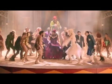
洋楽最新ヒット2020.08.20ディス・イズ・ミーグレイテスト・ショーマン・キャスト
洋楽人気動画2018.01.11グッド・ライフGイージー、ケラーニ
洋楽人気動画2017.01.27ホワット・ドゥ・ユー・ミーン?ジャスティン・ビーバー
洋楽人気動画2015.08.28ファイト・ソングレイチェル・プラッテン
洋楽人気動画2015.05.19ラヴ・ミー・ライク・ユー・ドゥエリー・ゴールディング
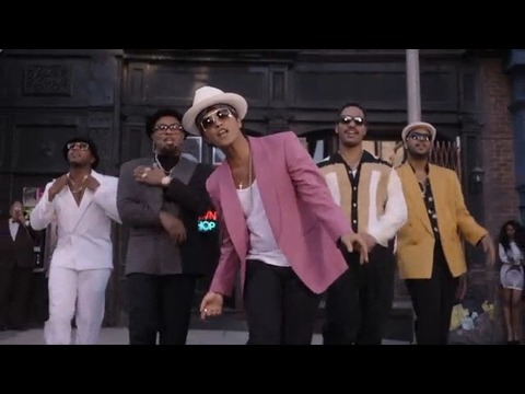
洋楽人気動画2015.01.22アップタウン・ファンクブルーノ・マーズ、マーク・ロンソン
洋楽人気動画2014.11.20ブレイク・フリーアリアナ・グランデ
洋楽人気動画2014.08.12ハッピーファレル・ウィリアムス
ポップス2014.01.08カウンティング・スターズワンリパブリック
ロック2013.05.31ア・サウザンド・イヤーズクリスティーナ・ペリー
洋楽人気動画2011.10.26ユー・レイズ・ミー・アップケルティック・ウーマン
洋楽人気動画2008.05.30ルーズ・ユアセルフエミネム
洋楽人気動画2008.02.21ドント・ノー・ホワイノラ・ジョーンズ
洋楽人気動画2008.02.15オンリー・タイムエンヤ
洋楽人気動画2007.10.03ミス・ア・シングエアロスミス
ロック2007.08.18タイム・トゥ・セイ・グッバイサラ・ブライトマン
洋楽人気動画2007.06.08シェイプ・オブ・マイ・ハートスティング
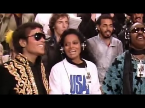
洋楽人気動画2007.03.18ウィ・アー・ザ・ワールド(U.S.A. フォー・アフリカ)マイケル・ジャクソン
洋楽人気動画2006.05.14ホテル・カリフォルニアイーグルス
ロック2005.07.06