TED日本語
TED Talks(英語 日本語字幕付き動画)
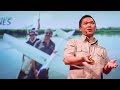
TED日本語 - リアン・ピン・コウ: 無人飛行機から見た環境保全
TED Talks
無人飛行機から見た環境保全
A drone's-eye view of conservation
リアン・ピン・コウ
Lian Pin Koh
内容
生態学者のリアン・ピン・コウ氏が、世界の森林と野生生物を保護するために、無人飛行機を活用することを提案します。無人機は軽量で自律飛行を行い、自然界に生息する動物の追跡や、熱帯雨林の健全性の観察、さらに赤外線画像から密猟者を見つけ出して犯罪に対抗することも可能にします。おまけに価格もお手頃です。


字幕
SCRIPT
Script
When we think of Nepal, we tend to think of the snow-capped mountains of the Himalayas, the crystal-clear still waters of its alpine lakes, or the huge expanse of its grasslands. What some of us may not realize is that in the Himalayan foothills, where the climate is much warmer and the landscape much greener, there lives a great diversity of wildlife, including the one-horned rhinoceros, the Asian elephant and the Bengal tiger. But unfortunately, these animals are under constant threat from poachers who hunt and kill them for their body parts. To stop the killing of these animals, battalions of soldiers and rangers are sent to protect Nepal's national parks, but that is not an easy task, because these soldiers have to patrol thousands of hectares of forests on foot or elephant backs. It is also risky for these soldiers when they get into gunfights with poachers, and therefore Nepal is always looking for new ways to help with protecting the forests and wildlife.
Well recently, Nepal acquired a new tool in the fight against wildlife crime, and these are drones, or more specifically, conservation drones. For about a year now, my colleagues and I have been building drones for Nepal and training the park protection personnel on the use of these drones. Not only does a drone give you a bird's-eye view of the landscape, but it also allows you to capture detailed, high-resolution images of objects on the ground. This, for example, is a pair of rhinoceros taking a cooling bath on a hot summer day in the lowlands of Nepal. Now we believe that drones have tremendous potential, not only for combating wildlife crime, but also for monitoring the health of these wildlife populations.
So what is a drone? Well, the kind of drone I'm talking about is simply a model aircraft fitted with an autopilot system, and this autopilot unit contains a tiny computer, a GPS, a compass, a barometric altimeter and a few other sensors. Now a drone like this is meant to carry a useful payload, such as a video camera or a photographic camera. It also requires a software that allows the user to program a mission, to tell the drone where to go.
Now people I talk to are often surprised when they hear that these are the only four components that make a conservation drone, but they are even more surprised when I tell them how affordablethese components are. The facts is, a conservation drone doesn't cost very much more than a good laptop computer or a decent pair of binoculars.
So now that you've builtyour own conservation drone, you probably want to go fly it, but how does one fly a drone? Well, actually, you don't, because the drone flies itself. All you have to do is to program a mission to tell the drone where to fly. But you simply do that by clicking on a few way points on the Google Maps interface using the open-source software. Those missions could be as simple as just a few way points, or they could be slightly longerand more complicated, to fly along a river system. Sometimes, we fly the dronein a lawnmower-type pattern and take pictures of that area, and those pictures can be processed to produce a map of that forest. Other researchers might want to fly the drone along the boundaries of a forest to watch out for poachers or people who might be trying to enter the forest illegally.
Now whatever your mission is, once you've programmed it, you simply upload it to the autopilot system, bring your drone to the field, and launch it simply by tossing it in the air. And often we'll go about this mission taking pictures or videos along the way, and usually at that point, we will go grab ourselves a cup of coffee, sit back, and relax for the next few minutes, although some of us sit backand panic for the next few minutes worrying that the drone will not return. Usually it does, and when it does, it even lands automatically.
So what can we do with a conservation drone? Well, when we built our first prototype drone, our main objective was to fly it over a remote rainforest in North Sumatra, Indonesia, to look for the nest of a species of great ape known as the orangutan. The reason we wanted to do that was because we needed to know how many individuals of this species are still left in that forest. Now the traditional method of surveying for orangutans is to walk the forest on foot carrying heavy equipment and to use a pair of binocularsto look up in the treetops where you might find an orangutan or its nest. Now as you can imagine, that is a very time-consuming, labor-intensive, and costly process, so we were hoping that drones could significantly reduce the cost of surveying for orangutan populations in Indonesia and elsewhere in Southeast Asia. So we were very excited when we captured our first pair of orangutan nests on camera. And this is it; this is the first ever picture of orangutan nests taken with a drone. Since then we have taken pictures of dozens of these nests from around various parts of Southeast Asia, and we're now working with computer scientists to develop algorithms that can automatically count the number of nests from the thousands of photos we've collected so far.
But nests are not the only objects these drones can detect. This is a wild orangutan happily feeding on top of a palm tree, seemingly oblivious to our dronethat was flying overhead, not once but several times. We've also taken pictures of other animals including forest buffalos in Gabon, elephants, and even turtle nests.
But besides taking picturesof just the animals themselves, we also take pictures of the habitatsthese animals live in, because we want to keep track of the health of these habitats. Sometimes, we zoom out a little and look at other things that might be happening in the landscape. This is an oil palm plantation in Sumatra. Now oil palm is a major driver of deforestation in that part of the world, so we wanted to use this new drone technology to keep track of the spread of these plantations in Southeast Asia. But drones could also be used to keep track of illegal logging activities. This is a recently logged forest, again in Sumatra. You could even still see the processed wooden planks left on the ground.
But perhaps the most exciting part about taking pictures from the air is we could later stitch these pictures together using special software to create a map of the entire landscape, and this map gives us crucial information for monitoring land use change, to let us know where and whenplantations might be expanding, where forests might be contracting, or where fires might be breaking out. Aerial images could also be processed to produce three-dimensional computer models of forests. Now these models are not just visually appealing, but they are also geometrically accurate, which means researchers can now measure the distance between trees, calculate surface area, the volume of vegetation, and so on, all of which are important information for monitoring the health of these forests. Recently, we've also begun experimenting with thermal imaging cameras. Now these cameras can detect heat-emitting objects from the ground, and therefore they are very usefulfor detecting poachers or their campfires at night.
So I've told you quite a lot about what conservation drones are, how you might operate one of these drones, and what a drone could do for you. I will now tell you where conservation drones are being used around the world. We built our first prototype drones in Switzerland. We brought a few of these to Indonesia for the first few test flights. Since then, we've been building drones for our collaborators from around the world, and these include fellow biologists and partners from major conservation organizations.
Perhaps the best and most rewarding part about working with these collaborators is the feedback they give us on how to improve our drones. Building drones for us is a constant work in progress. We are constantly trying to improve them in terms of their range, their ruggedness, and the amount of payload they can carry. We also work with collaborators to discover new ways of using these drones. For example, camera traps are a common tool used by biologists to take pictures of shy animals hiding in the forests, but these are motion-activated cameras, so they snap a picture every time an animal crosses their path. But the problem with camera traps is that the researcher has to go back to the forest every so often to retrieve those images, and that takes a lot of time, especially if there are dozens or hundreds of these cameras placed in the forest. Now a drone could be designed to perform the task much more efficiently. This drone, carrying a special sensor, could be flown over the forest and remotely download these images from wi-fi窶兎nabled cameras.
Radio collars are another tool that's commonly used by biologists. Now these collars are put onto animals. They transmit a radio signal which allows the researcher to track the movementsof these animals across the landscape. But the traditional way of tracking animals is pretty ridiculous, because it requires the researcher to be walking on the ground carrying a hugeand cumbersome radio antenna, not unlike those old TV antennae we used to have on our rooftops. Some of us still do. A drone could be used to do the same job much more efficiently. Why not equip a drone with a scanning radio receiver, fly that over the forest canopy in a certain pattern which would allow the user or the operator to triangulate the location of these radio-collared animals remotely without having to step foot in the forest.
A third and perhaps most exciting way of using these drones is to fly them to a really remote, never-explored-before rainforest somewhere hidden in the tropics, and parachute down a tiny spy microphone that would allow us to eavesdrop on the calls of mammals, birds, amphibians, the Yeti, the Sasquatch, Bigfoot, whatever. That would give us biologists a pretty good idea of what animals might be living in those forests.
And finally, I would like to show you the latest version of our conservation drone. The MAJA drone has a wingspan of about two meters. It weighs only about two kilograms, but it can carry half its weight. It is a fully autonomous system. During its mission, it can even transmit a live video feed back to a ground station laptop, which allows the user to see what the drone is seeing in real time. It carries a variety of sensors, and the photo quality of some of these sensors can be as high as one to two centimeters per pixel. This drone can stay in the air for 40 to 60 minutes, which gives it a range of up to 50 kilometers. That is quite sufficient for most of our conservation applications.
Now, conservation drones began as a crazy idea from two biologists who are just deeply passionateabout this technology. And we believe, strongly believe, that drones can and will be a game changer for conservation research and applications. We've had our fair share of skeptics and critics who thought that we were justfooling around with toy planes. And in a way, they are right. I mean, let's be honest, drones are the ultimate toys for boys. But at the same time, we've also gotten to know many wonderful colleagues and collaborators who share our vision and see the potential of conservation drones. To us, it is obvious that conservation biologists and practitioners should make full use of every available tool, including drones, in our fight to save the last remaining forests and wildlife of this planet.
Thank you.
(Applause)
ネパールのことを思い浮かべるとき 私たちが想像しがちなのは 雪を被ったヒマラヤ山脈や 高山湖の澄み切った穏やかな湖水 広大な草原などです 一部の人は知らないかもしれません ヒマラヤの山麓の丘 ― そこは気候がとても暖かく 一面に緑が広がる景観で そこには多様な野生生物 例えば 一角サイや アジアゾウ ベンガルトラなどが暮らしています しかし 残念ながらこれらの動物は 常に 密猟の脅威にさらされています 密猟者は 体の一部が欲しいがために動物を捕えて殺します 動物殺害を阻止するため 大量の兵士と森林警備隊が送られています しかし ネパールの国立公園を保護することは 容易ではありません なぜなら 兵士たちは 何千ヘクタールという森林を徒歩か 象の背中に乗って パトロールするからです さらに 彼らにとって危険なのは 密猟者との銃撃戦になることです そのため ネパールは常に 森林と野生生物の保護に役立つ 新しい手段を探し続けています
そこで最近 ネパールは新しいツールを入手しました 野生生物犯罪に立ち向かうためです それは無人飛行機で より厳密に言うと無人保全機です この一年で 同僚と私は ネパールのために無人機を作ると共に 公園保護にあたる職員に対して 操縦訓練を行いました 無人機によって 上空から 景色を一望できるだけでなく 地上にあるものを細かいところまで 高画質な画像で捉えることが出来ます 例えば これは 2匹のサイが 暑い夏の日に ネパールの低地で 水浴びをしている様子です 現在 確信していることは無人機がもつ 多大な潜在能力によって 野生生物犯罪に対抗するだけでなく 野生生物の健康状態さえも 観察できるようになります
無人機とは どんなものでしょう 今 お話している無人機は 単なる模型飛行機で 自動操縦システムを搭載しています この自動操縦装置には小さなコンピューターや GPS コンパス 気圧高度計 さらに 幾つかのセンサーが入っています このような無人機は 目的に応じた機材を搭載できます 例えば ビデオカメラや 写真用カメラなどです またソフトフェアも必要になります 利用者がミッションをプログラムし 無人機に飛行経路を指示します
多くの皆さんが驚くことは 無人保全機がたった4つの部品で成り立っていることです これらの部品が いかに手頃な価格かを話すともっと驚かれます 実際 無人保全機は そんなにお金がかかりません 普通のノートパソコンや ちゃんとした双眼鏡よりも安いのです
そこで あなた自身の無人保全機を作ったとしたら きっとそれを飛ばしたいですよね でも どうやって無人機を飛ばすか 実は あなたが飛ばすのではなく 無人機が自ら飛ぶんです あなたはただミッションをプログラムし 無人機に飛行経路を指示するだけ 正確には 単にポイントをクリックするのみです オープンソース・ソフトウェアを使って グーグルマップ上に経由地を指定するのです 飛行経路は シンプルに 数か所の地点を選ぶことも出来るし もっと長く複雑にして川に沿った経路も選べます 時には 芝刈り機のような飛行経路で そのエリアの写真を撮影します 撮った写真は 森林地帯の地図作りに活かされます 無人機を森林の境界に沿って 飛ばしたいという研究者もいるでしょう 密猟者や森に不法侵入する人を見張るためです
どんなミッションでも 一度プログラム化してしまえば 後は自動操縦システムにアップロードし 無人機を外に持ちだし 空に投げ上げれば飛行開始です 私たちのミッションの多くは 写真やビデオを撮影するものです 撮影が始まってしまえば たいていは コーヒーを取りに行き しばらくは のんびりと待つのです のんびりとできないで無人機が戻らなかったらどうしようと パニックになる人もいますけどね 大抵 無人機は戻り 着陸すら自動で行います
では 無人保全機を使って何が出来るでしょうか 無人機の試作をした当初の 主な目的は インドネシア・スマトラ北部の辺ぴな熱帯雨林を飛行し オランウータンとして知られる類人猿の ねぐらを探すことでした これを行いたかった理由は この森に残っているオランウータンの数を 知る必要があったからです オランウータン調査の従来の方法はこうです 重い機材を持って 徒歩で森林に入っていきます そして双眼鏡を使って オランウータン もしくは 彼らのねぐらが生息する可能性のあるこずえを調べます 皆さんのお察し通り これは多大な時間と労力 さらに 大変 費用のかかるプロセスです ですから 無人機によって コストを大幅に減らして インドネシアを始めとする東南アジアでの オランウータン個体数調査ができればと願っていました オランウータンのねぐらを 初めてカメラで捉えたときにはたいへん興奮しました これが無人機によって 初めて 撮影されたオランウータンのねぐらです その以来 何十というねぐらを 写真に収めました ねぐらは東南アジアの各地で確認されています 現在では コンピューター科学者と連携し アルゴリズムの開発を行っており これまで収集した大量の写真から 自動で巣をカウントできるようにしています
しかし 無人機が見つけ出せる物は巣だけではありません これは野生のオランウータンが 幸せそうにヤシの木の上で食事しているところです 無人機が 頭上を何度も飛んでいたのに 気にしていないようです 同様に 他の動物も撮影しました ガボンのバッファローや ゾウや カメの巣穴も撮られています
しかし ただ動物自体の写真を撮るのではなく 彼らの生息場所も撮影します なぜなら 生息地の健全性を把握したいからです 時には画面をズームアウトし まわりで 何か起こっていないか 調べます これはスマトラのアブラヤシ農園です 現在 この地域ではアブラヤシが森林破壊の 大きな要因となっています そこで この新しい無人機の技術を 拡大する東南アジアの森林破壊を監視するために 使用することを考えました 無人機があれば違法伐採活動についても 状況を把握できるかもしれません これは 最近伐採された森林で これもまた スマトラです 切り出された木材が まだ地面に置かれている様子が見えます
空から写真を撮って 最もワクワクするのは 実はこの後です 特別なソフトウェアを使って 写真を繋ぎ合わせ 景観全体の地図を作成しますこの地図によって 土地利用の変化を監視する上で 非常に重要な情報が得られます 農園が拡大しているらしい 森林が縮小し始めている 火災が発生した等の変化がどこで起きたかわかります 空撮画像を加工することによって 森林の3Dモデルを 制作できます 3Dモデルは 見た目が美しいだけでなく 幾何学的にもとても正確です つまり これによって研究者は 木の間隔を測定し 表面積や植物の生育量などが計算できるのです これらの全てが 森林の健全性を監視するための重要な情報となります 最近 私たちが試し始めたものは 赤外線画像カメラです このカメラが探知できるものは 地上から 熱を放射している物体です そのため 密猟者や夜のたき火を見つけ出すのにとても役立っています
私が今までお話してきたことは 無人保全機とは何か 無人機をどう操縦できるか 無人機があなたに何をもたらすかでした これからお話することは無人保全機が 世界のどこで利用されているかです 最初の試作無人機はスイスで制作しました これらの何機かをインドネシアへ運び 数回 試験飛行しました それ以来 無人機を制作し続けました 世界中に 生物学者をはじめとする 共同研究者がいます 大きな保護団体とも協力しています
多くの共同研究を進めて 最も実りがあるのは 無人機を改善するための フィードバックをもらえることです 無人機の開発に 完成はありません 継続的に改良を試みている個所は 航続距離や耐久性 最大積載量などです また 共同研究の中で 無人機の新たな活用性を見出しています 例えば カメラトラップは一般的な手法で 生物学者が森に潜む シャイな動物を撮影するために使用しています このカメラは動きに反応するため 動物が道を横切るたびに 写真が撮れるのです カメラトラップの問題点は 研究者が しょっちゅう戻って 画像データを回収しないといけないことで とても時間がかかります もし 何十 何百もの カメラを設置していたらなおさらです でも無人機を使えばこの作業をずっと効率的に 行うことができます 無人機に特別なセンサーを搭載させて 森林の上空を飛行させ 遠隔操作で画像をダウンロードできるようにします ワイ・ファイ対応のカメラからです
発信機付の首輪も 生物学者によく使われています これらの首輪は 現在動物に付けられています 首輪から送信される無線信号によって 研究者はフィールドの全域にわたって動物の行動を追跡できるようになります しかし従来の動物追跡の方法は とても馬鹿げています なぜなら研究員に地上を歩かせ 巨大で煩わしいアンテナを担いでまわる必要があります 屋根の上に取り付けていたテレビのアンテナほどではないにしろ 一部の研究者はいまだにそれを担いで移動します 無人機は 同じ作業をより効率的に行えます そこで 無人機に 走査無線受信機を設置して 林冠上空を特定のパターンで 飛行してみます それによって利用者や操縦者は 発信機を付けた動物の位置を 離れた場所から三角測量できるようになり 森林に足を踏み入れる必要もありません
3番目の恐らく最も刺激的な 無人機の利用方法は 非常に辺ぴな場所を飛行すること 熱帯地方に埋もれている未踏の熱帯雨林に 無人機を飛ばして 小さな隠しマイクをパラシュート降下させます マイクを通じて様々な鳴き声を聞けます 哺乳類 鳥類 両生類 イエティ サスカッチビッグフットなど 何でもです これによって私たち生物学者は これらの森に どんな動物がいるか 予想をすることができます
最後に 皆さんにお見せしたいものは 最新の無人保全機です 無人保全機 MAJAは 翼長が約2メートルです 重量はたったの2キロですが 自重の半分の機材を積載できます さらに 完全自律システムです 作業中に 生映像のストリームを 地上局のパソコンに送信することが出来ます つまり 利用者は リアルタイムで 無人機からの視界が見えるのです 様々なセンサーを搭載し これらのセンサーの写真の解像度は 1画素あたり1~2センチという高画質です この無人機は 40から60分間の連続飛行が可能で 最大飛行距離は50キロです これは私たちの保全用途を満たすのに十分です
無人保全機の始まりは このテクノロジーに深い情熱をもつ二人の生物学者の突拍子もない発想からでした そして 私たちが強く確信していることは 無人機が 自然保護の研究と実地応用に 大変革をもたらせるということです 懐疑派や反対派がかなりいました ただオモチャの飛行機をいじっているだけだと ある意味 彼らは正しい 正直言うと 無人機は 男には最高のオモチャです しかし同時に得たものもあります 沢山の素晴らしい同僚や共同研究者と ビションを分かち合い 無人保全機の潜在能力を見いだしました 私たちにとって 明らかなことは保全生物学者と 保護の現場では 利用できる 全ての手段 ― 無人機などを活用し この惑星に残された最後の森林と野生生物を 救うために戦うべきです
有難うございました
(拍手)
品詞分類
- 主語
- 動詞
- 助動詞
- 準動詞
- 関係詞等
TED 日本語
TED Talks
関連動画

太陽光エネルギーの美しい未来マヤン・ファン・アウベル
2019.03.22ネット通販で返品した物の行き先は?アパルナ・メータ
2018.12.13繁栄する持続可能な世界を築く5つの革新的な政策 - TED Talkヨハン・ロックストローム
2018.11.07ファッション業界のゴミ問題への3つの解決法アミット・カルラ
2018.03.09海洋プラスチックごみに対する驚くべき解決策デイヴィッド・カッツ
2018.02.16地球を守るための経済的考察石井菜穂子
2018.02.143つの賢い節水方法ラナ・マザラ
2018.01.24スモッグ掃除機をはじめとする夢のような都市デザインの数々ダーン・ローゼハーデ
2017.09.19アプリで楽しくゴミ拾いジェフ・キルシュナー
2017.03.22小さな国の大きなアイディア ― 化石燃料なき発展を目指してモニカ・アラヤ
2016.09.06緑も人も健康になれる禁断のヒミツモリー・ウィンター
2016.09.02自宅の裏庭に森を作る方法シュベンデュ・シャルマ
2016.08.22自然はどこにでもある ― 自然の見つけ方を学びましょうエマ・マリス
2016.08.19子どもたちが成し遂げた「バリのレジ袋廃止運動」メラティ&イサベル・ワイゼン
おすすめ 22016.02.19どのように私は有害な植物を繁栄するビジネスに変えたのかアチェニョ・イダチャバ
2016.02.11壊滅的な水不足を避ける4つの方法デイビッド・セドラック
2016.01.29


洋楽 おすすめ
RECOMMENDS
洋楽歌詞
ダイナマイトビーティーエス
洋楽最新ヒット2020.08.20ディス・イズ・ミーグレイテスト・ショーマン・キャスト
洋楽人気動画2018.01.11グッド・ライフGイージー、ケラーニ
洋楽人気動画2017.01.27ホワット・ドゥ・ユー・ミーン?ジャスティン・ビーバー
洋楽人気動画2015.08.28ファイト・ソングレイチェル・プラッテン
洋楽人気動画2015.05.19ラヴ・ミー・ライク・ユー・ドゥエリー・ゴールディング
洋楽人気動画2015.01.22アップタウン・ファンクブルーノ・マーズ、マーク・ロンソン
洋楽人気動画2014.11.20ブレイク・フリーアリアナ・グランデ
洋楽人気動画2014.08.12ハッピーファレル・ウィリアムス
ポップス2014.01.08カウンティング・スターズワンリパブリック
ロック2013.05.31ア・サウザンド・イヤーズクリスティーナ・ペリー
洋楽人気動画2011.10.26ユー・レイズ・ミー・アップケルティック・ウーマン
洋楽人気動画2008.05.30ルーズ・ユアセルフエミネム
洋楽人気動画2008.02.21ドント・ノー・ホワイノラ・ジョーンズ
洋楽人気動画2008.02.15オンリー・タイムエンヤ
洋楽人気動画2007.10.03ミス・ア・シングエアロスミス
ロック2007.08.18タイム・トゥ・セイ・グッバイサラ・ブライトマン
洋楽人気動画2007.06.08シェイプ・オブ・マイ・ハートスティング
洋楽人気動画2007.03.18ウィ・アー・ザ・ワールド(U.S.A. フォー・アフリカ)マイケル・ジャクソン
洋楽人気動画2006.05.14ホテル・カリフォルニアイーグルス
ロック2005.07.06