TED日本語
TED Talks(英語 日本語字幕付き動画)
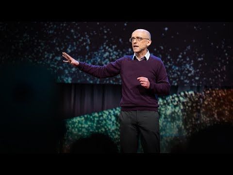
TED日本語 - カーター・エマート: 三次元宇宙地図のデモ
TED Talks
三次元宇宙地図のデモ
Carter Emmart demos a 3D atlas of the universe
カーター・エマート
内容
過去12年間、カーター・エマートは科学者、芸術家やプログラマーと共に宇宙の完全な三次元視覚化の構築に取り組んできました。この驚くべき旅をデモすると共に、どのようにしてこれが世界中の施設に共有されているかを説明します。


字幕
SCRIPT
Script
It's a great honor today to share with you The Digital Universe, which was created for humanity to really see where we are in the universe. And so I think we can roll the video that we have.
[ The Himalayas. ]
(Music)
The flat horizon that we've evolved with has been a metaphor for the infinite: unbounded resources and unlimited capacity for disposal of waste. It wasn't until we really left Earth, got above the atmosphere and had seen the horizon bend back on itself, that we could understand our planet as a limited condition. The Digital Universe Atlas has been built at the American Museum of Natural History over the past 12 years. We maintain that, put that together as a project to really chart the universe across all scales. What we see here are satellites around the Earth and the Earth in proper registration against the universe, as we see. NASA supported this work 12 years ago as part of the rebuilding of the Hayden Planetarium so that we would share this with the world.
The Digital Universe is the basis of our space show productions that we do -- our main space shows in the dome. But what you see here is the result of, actually, internships that we hosted with Linkoping University in Sweden. I've had 12 students work on this for their graduate work, and the result has been this software called Uniview and a company called SCISS in Sweden. This software allows interactive use, so this actual flight path and movie that we see here was actually flown live. I captured this live from my laptop in a cafe called Earth Matters on the Lower East Side of Manhattan, where I live, and it was done as a collaborative project with the Rubin Museum of Himalayan Art for an exhibit on comparative cosmology.
And so as we move out, we see continuously from our planet all the way out into the realm of galaxies, as we see here, light-travel time, giving you a sense of how far away we are. As we move out, the light from these distant galaxies have taken so long, we're essentially backing up into the past. We back so far up we're finally seeing a containment around us -- the afterglow of the Big Bang. This is the WMAP microwave background that we see. We'll fly outside it here, just to see this sort of containment. If we were outside this, it would almost be meaningless, in the sense as before time. But this our containment of the visible universe. We know the universe is bigger than that which we can see.
Coming back quickly, we see here the radio sphere that we jumped out of in the beginning, but these are positions, the latest positions of exoplanets that we've mapped, and our sun here, obviously, with our own solar system. What you're going to see -- we're going to have to jump in here pretty quickly between several orders of magnitude to get down to where we see the solar system -- these are the paths of Voyager 1, Voyager 2, Pioneer 11 and Pioneer 10, the first four spacecraft to have left the solar system. Coming in closer, picking up Earth, orbit of the Moon, and we see the Earth. This map can be updated, and we can add in new data.
I know Dr. Carolyn Porco is the camera P.I. for the Cassini mission. But here we see the complex trajectory of the Cassini mission color coded for different mission phases, ingeniously developed so that 45 encounters with the largest moon, Titan, which is larger that the planet Mercury, diverts the orbit into different parts of mission phase.
This software allows us to come close and look at parts of this. This software can also be networked between domes. We have a growing user base of this, and we network domes. And we can network between domes and classrooms. We're actually sharing tours of the universe with the first sub-Saharan planetarium in Ghana as well as new libraries that have been built in the ghettos in Columbia and a high school in Cambodia. And the Cambodians have actually controlled the Hayden Planetarium from their high school.
This is an image from Saturday, photographed by the Aqua satellite, but through the Uniview software. So you're seeing the edge of the Earth. This is Nepal. This is, in fact, right here is the valley of Lhasa, right here in Tibet. But we can see the haze from fires and so forth in the Ganges valley down below in India. This is Nepal and Tibet.
And just in closing, I'd just like to say this beautiful world that we live on -- here we see a bit of the snow that some of you may have had to brave in coming out -- so I'd like to just say that what the world needs now is a sense of being able to look at ourselves in this much larger condition now and a much larger sense of what home is. Because our home is the universe, and we are the universe, essentially. We carry that in us. And to be able to see our context in this larger sense at all scales helps us all, I think, in understanding where we are and who we are in the universe.
Thank you.
(Applause)
今日は皆さんに Digital Universeをご紹介できることを 大変光栄に思います これは私たち人類が宇宙において どこに存在しているのかを 知る為に制作しました それではビデオを流しましょう
[ヒマラヤ山脈]
(音楽)
カーター=エマート:人類の進化と共にあった平らな水平線は 限りない資源と 廃棄物の処理に対する 無制限の許容量といった 無限性を象徴するものでした しかし 人類が 初めて地球を出て 大気圏外から 水平線が 折れ曲がっているのを見て 地球の有限性に 人々は気づくことになります Digital Universe Atlas の 製作は アメリカ自然史博物館にて 12年前に着手されました そのメンテナンスをし続け 一つのプロジェクトとして まとめることで 宇宙をあらゆるスケールで 視覚化できるようにしました 今ご覧になっているのは地球を回る衛星と 宇宙に対して正確に登録された 地球です 12年前にNASAが このプロジェクトを ハイデン プラネタリウムの改築の 一環として世界に向けて 公開できるように 支援してくれました
Digital Universeは 私たちがドームで行っている メインの宇宙ショー製作の中核を担うものです でも ここでご覧になられているのは スウェーデンのリンコピン大学と 提携したインターシップによって できたものです これを12人の学生に 彼らの卒業制作として 取り組んでもらいました その結果 この Univiewと呼ばれるソフトウェアと スウェーデンにある SCISSという会社が生まれたのです このソフトウェアは 双方向で利用できます この実際の飛行経路と 私たちが見ている動画は 編集されていないライブ映像です この動画は私の住んでいるマンハッタンの東側にある Earth Mattersと呼ばれるカフェで ノートパソコンを使ってキャプチャーしました これはルビン美術館との 共同プロジェクトとして 比較宇宙論における 展示用に 作ったものです
このように外へ遠ざかることで 地球からはるかに遠い銀河を見る事ができ 光の速さで進むことで どれだけ遠くまで来たかを 感じることができます 更に外へ向かうと これらの離れた惑星の光は 長い時間がかかっていることから 本質的に過去へと遡り始めます ずっと昔まで遡ることによって ようやく周囲を包み込む構造体のようなもの -- ビッグバンの残光を見る事ができます これはWMAPで得られた マイクロ波背景放射が 見えているところです ここでこの構造体を見るために 外周部周辺を回ります もしここの外を出たら 時間の生まれる前の状態にあるので ほとんど無意味です これが私たちの可視宇宙の構造です 宇宙は想像以上に巨大であることが分かります
急いで戻ってみると 始めに私たちが飛び出した球体が見えます これは 私たちがマッピングした 最新の太陽系外惑星の位置です 太陽をはじめとする太陽系も確認できます ここからはかなり急いで飛び込んでいかなければなりません 何桁分か拡大することで 太陽系を確認するようにします これらは ボイジャー1号と2号 パイオニア10号と11号の軌跡です 太陽系を離れた初めの4機の宇宙探査機です 近づいて 地球を捕捉しました 月の軌道に 地球を確認しました この地図は更新でき 新しいデータを追加できます
知人のキャロリン=ポルコ博士は カッシーニ計画のカメラ部門責任者です ここではカッシーニ計画において ミッション毎に色付けされた 複雑な軌跡を表示しています 水星よりも大きな 最大の月である タイタンに45回近づけるように 様々なミッションのフェーズ毎に 軌道をそらすように精巧に開発されています
このソフトウェアのおかげで こういったものに近づくことができます このソフトウェアはドーム間でネットワーク接続することができるため ユーザー基盤を広げています ドームを繋げるばかりか ドームと教室を繋げることもできます 私たちは実際に宇宙の旅を ガーナにあるサハラ以南初の プラネタリウムと 共有することをはじめとし 図書館が新しく建てられた コロンビアのスラム街や カンボジアの 高校にも宇宙の旅を共有しました カンボジアの学生は ハイデン プラネタリウムを彼らの高校から実際に操作しました
これは日曜日に 衛星アクアが撮影した画像をUniviewによって投影しています ご覧になっているのは地球の端です これはネパールです ここがラサの谷で ここはチベットです その下のインドでは ガンジス谷の火によるかすみが 見えます ここがネパールとチベットです
最後に私たちが生きている この美しい世界についてお話したいと思います ここは少し雪が積もっていますが 何人かはここから出発されたと思います 私が伝えたいのは 今世界が必要としているのは より大きな尺度で 自らを見つめ直すことができ より大きな視点でふるさとについて考えることができる能力です 私たちのふるさとは宇宙であり 私たちは宇宙の一部でもあるのです これは全員に当てはまることです 私たちの状況を あらゆるスケールで俯瞰することは 私たちが宇宙においてどこにいて 私たちが何者なのかを理解する上で役立つはずです
ありがとうございました
(拍手)
品詞分類
- 主語
- 動詞
- 助動詞
- 準動詞
- 関係詞等
TED 日本語
TED Talks
関連動画

謎に包まれた土星の衛星タイタンを調べて生命の起源に関して何がわかるかエリザベス・ジビ・タートル
2020.09.17宇宙に関する理解に疑問を抱かせる珍しい銀河ブーチン・ムトゥル・パクディル
2018.09.18宇宙人はどこにいるのでしょう?スティーヴン・ウェッブ
2018.08.16他の恒星系からの初の訪問者オウムアムアカレン・J・ミーチ
2018.07.19地球上で最も火星によく似た場所アルマンド・アズア・ブストス
2017.10.05あなたは皆既日食を是非体験すべきであるデイヴィッド・バロン
2017.08.10ブラックホールの写真を撮影するケイティ・バウマン
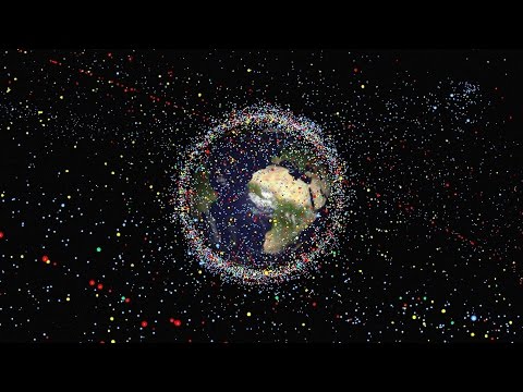
2017.04.28地球を周回している宇宙ゴミを片付けましょうナタリー・パネク
2017.01.05地球外生命を宿しているかもしれない1つの惑星と3つの衛星ジェームズ・グリーン
2016.09.07惑星が生命を育むために必要なものデイヴ・ブレイン
2016.09.04火星に移住する子供達が生き抜く方法スティーブン・ペトラネック
2016.05.05宇宙でもっとも神秘的な星タベサ・ボヤジアン
2016.04.29重力波発見が意味することアラン・アダムス
2016.03.10他の惑星の生命を見つけ出す方法アオマワ・シールズ
2016.01.28物理学は終焉に達したのか?ハリー・クリフ
2016.01.26火星は予備の地球ではないルシアン・ウォーコウィッチ
2016.01.14
洋楽 おすすめ
RECOMMENDS
洋楽歌詞
ダイナマイトビーティーエス
洋楽最新ヒット2020.08.20ディス・イズ・ミーグレイテスト・ショーマン・キャスト
洋楽人気動画2018.01.11グッド・ライフGイージー、ケラーニ
洋楽人気動画2017.01.27ホワット・ドゥ・ユー・ミーン?ジャスティン・ビーバー
洋楽人気動画2015.08.28ファイト・ソングレイチェル・プラッテン
洋楽人気動画2015.05.19ラヴ・ミー・ライク・ユー・ドゥエリー・ゴールディング
洋楽人気動画2015.01.22アップタウン・ファンクブルーノ・マーズ、マーク・ロンソン
洋楽人気動画2014.11.20ブレイク・フリーアリアナ・グランデ
洋楽人気動画2014.08.12ハッピーファレル・ウィリアムス
ポップス2014.01.08カウンティング・スターズワンリパブリック
ロック2013.05.31ア・サウザンド・イヤーズクリスティーナ・ペリー
洋楽人気動画2011.10.26ユー・レイズ・ミー・アップケルティック・ウーマン
洋楽人気動画2008.05.30ルーズ・ユアセルフエミネム
洋楽人気動画2008.02.21ドント・ノー・ホワイノラ・ジョーンズ
洋楽人気動画2008.02.15オンリー・タイムエンヤ
洋楽人気動画2007.10.03ミス・ア・シングエアロスミス
ロック2007.08.18タイム・トゥ・セイ・グッバイサラ・ブライトマン
洋楽人気動画2007.06.08シェイプ・オブ・マイ・ハートスティング
洋楽人気動画2007.03.18ウィ・アー・ザ・ワールド(U.S.A. フォー・アフリカ)マイケル・ジャクソン
洋楽人気動画2006.05.14ホテル・カリフォルニアイーグルス
ロック2005.07.06