TED日本語
TED Talks(英語 日本語字幕付き動画)
TED日本語 - ブレイス・アグエラ・ヤルカス: 新世代地図の実演
TED Talks
新世代地図の実演
Blaise Aguera y Arcas demos augmented-reality maps
ブレイス・アグエラ・ヤルカス
内容
TED2010で観衆が息を飲んだデモンストレーションにてブレイス・アグエラ・ヤルカスがマイクロソフトの拡張現実的地図の実演をお見せします。


字幕
SCRIPT
Script

About a year and a half ago, Stephen Lawler, who also gave a talk here at TED in 2007 on Virtual Earth, brought me over to become the architect of Bing Maps, which is Microsoft's online-mapping effort. In the past two and a half, we've been very hard at work on redefining the way maps work online. And we really are seeing this in very different terms from the kind of mapping and direction site that one is used to.
So, the first thing that you might notice about the mapping site is just the fluidity of the zooming and the panning, which, if you're familiar at all with Seadragon, that's where it comes from.
Mapping is, of course, not just about cartography, it's also about imagery. So, as we zoom-in beyond a certain level this resolves into a kind of Sim City-like virtual view at 45 degrees. This can be viewed from any of the cardinal directions to show you the 3D structure of the city, all the facades. Now, we see this space, this three-dimensional environment, as being a canvas on which all sorts of applications can play out, and map's directions are really just one of them.
If you click on this, you'll see some of the ones that we've put out, just in the past couple of months since we've launched. So, for example, a couple of days after the disaster in Haiti, we had an earthquake map that showed before and after pictures from the sky. This wonderful one which I don't have time to show you is taking hyper-local blogs in real time and mapping those stories, those entries to the places that are referred to on the blogs. It's wonderful.
But I'm going to show you some more candy sort of stuff.
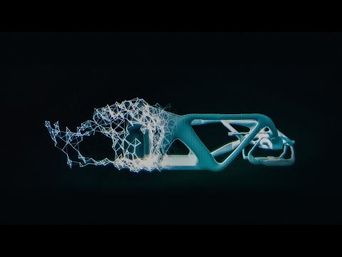
So, we see the imagery, of course, not stopping at the sky. These little green bubbles represent photosynths that users have made. I'm not going to dive into them either, but photosynths are integrated into the map. Everything that's cased in blue is an area where we've taken imagery on the ground as well.
And so, when you fly down --
(Applause)
Thank you. When you fly down to the ground, and you see this kind of panoramic imagery, the first thing that you might notice is that it's not just a picture, there's just as much three-dimensional understanding of this environment as there is of the three-dimensional city from above, so if I click on something to get a closer view of it, then, the fact that that transition looks as it does, is a function of all of that geometry, all of that 3D understanding behind this model.
Now, I'll show you a fun app that -- we've been working on a collaboration with our friends at Flickr. This takes Flickr, georegistered imagery and uses photosynth-like processes to connect that imagery to our imagery, so -- I'm not sure if that's the one I actually meant to pull up, but --
(Laughter)
But notice -- this is, of course, a popular tourist site, and there are lots of photos around here, and these photos are all taken at different times. So this one was taken around five. So that's the Flickr photo, that's our imagery. So you really see how this kind of crowd-sourced imagery is integrating, in a very deep way, into the map itself.
(Applause)
Thank you.
(Applause)
There are several reasons why this is interesting and one of them, of course, is time travel. And I'm not going to show you some of the wonderful historic imagery in here, but there are some with horses and carriages and so on as well. But what's cool about this is that, not only is it augmenting this visual representation of the world with things that are coming in from users, but it also is the foundation for augmented reality, and that's something that I'll be showing you more of in just a moment.
Now I just made a transition indoors. That's also interesting. OK, notice there's now a roof above us. We're inside the Pike Place Market. And this is something that we're able to do with a backpack camera, so, we're now not only imaging in the street with this camera on tops of cars, but we're also imaging inside. And from here, we're able to do the same sorts of registration, not only of still images, but also of video.
So this is something that we're now going to try for the first time, live, and this is really, truly, very frightening.
(Laughter)
(Ringing)
All right, guys, are you there?
(Noise)
All right. I'm hitting it. I'm punching play. I'm live. All right. There we go. So, these are our friends in Pike Place Market, the lab.
(Applause)
So they're broadcasting this live. OK, George, can you pan back over to the corner market? Because I want to show points of interest. No, no. The other way. Yeah, yeah, back to the corner, back to the corner. I don't want to see you guys yet. OK, OK, back to the corner, back to the corner, back to the corner. OK, never mind.
What I wanted to show you was these points of interest over here on top of the image because what that gives you a sense of is the way, if you're actually on the spot, you can think about this -- this is taking a step in addition to augmented reality.
What the hell are you guys -- oh, sorry.
(Laughter)
We're doing two different -- OK, I'm hanging up now. We're doing two different things here. One of them is to take that real ...
(Laughter)
All right, let me just take a moment and thank the team. They've done a fantastic job of pulling this together.
(Applause)
I'm going to abandon them now and walk back outside. And while I walk outside, I'll just mention that here we're using this for telepresence, but you can equally well use this on the spot, for augmented reality. When you use it on the spot, it means that you're able to bring all of that metadata and information about the world to you. So here, we're taking the extra step of also broadcasting it. That was being broadcast, by the way, on a 4G network from the market.
All right, and now there's one last TED talk that Microsoft has given in the past several years. And that's Curtis Wong, WorldWide Telescope. So, we're going to head over to the dumpsters, where it's traditional, after a long day at the market, to go out for a break, but also stare up at the sky. This is the integration of WorldWide Telescope into our maps.
(Applause)
This is the current -- thank you -- this is the current time. If we scrub the time, then we can see how the sky will look at different times, and we can get all of this very detailed information about different times, different dates: Let's move the moon a little higher in the sky, maybe change the date. I would like to kind of zoom in on the moon. So, this is an astronomically complete representation of the sky integrated right into the Earth.
All right now, I've overrun my time, so I've got to stop. Thank you all very much.
(Applause)
このTEDの場で2007年に公演をした スティーブン ローラ-によって、私は1年半前くらいに マイクロソフトが取り組んでいる オンラインマップ Bing Maps の アーキテクトに取り立てられました。 ここ2年半でオンライン上の地図の仕組みを 再定義するため一生懸命働きましたね。 そうして以前あったような地図サイトや ナビサイトとは大きく異なるものが 出来てきていると思います。
この地図を見て初めに気付くことは 流れるような拡大とパンの動きでしょう。 Seadragonをご存知かもしれませんが これはその技術を使っています。
もちろん地図には ただの地図だけでなく 画像のものもあります。 そこである解像度を越えて拡大していくと 斜め45度からのシムシティみたいな 3D地図が見えてきます。 全ての外観、3D構造を東西南北 どこからでも見ることができます。 今我々はこの3D仮想空間をあらゆるソフトが 稼働することが出来る 真っ白なキャンバスだと思っています。 そして道案内機能はそのうちのほんの一部なのです。
ここをクリックすると 数ヶ月の間に追加してきたソフトの幾つかを 見ることができます。 例えばハイチの大災害の2、3日後、我々は地震の 発生以前と後の衛星画像を映し出す 地震地図というものを用意していました。 今日時間の都合でお見せできないのですが、 この素晴らしい機能は地元のブログにリアルタイムで アクセスし、ブログに投稿のあるエントリーを それが言及している所の地図上に表示します。 すごいでしょ?
けど今はもう少し楽しみが持てそうな物を少しお見せしましょう。
ここで皆さんが目にする写真は 衛星写真にとどまりません。 この小さな緑色の粒粒はユーザーが作ってくれた Photosynthです。これもこれ以上 深入りはしませんがPhotosynthのデータを地図に埋め込むものです。 青色で囲まれている個所は既に 地上での画像も撮り終えてある地域です。
そこで下に降りていくと--
(拍手)
ありがとう。地上に降りていくと、 この様にパノラマ画像が見えてきます。 まず皆さんが初めに気付くことは、これは単なる写真ではなく 上空からの3D画像を見ることが出来た様に 地上レベルでも環境が3次元的に把握されています。 そこでもっと近づいてみるために何かクリックしてみましょう。 3次元モデルと幾何学に基づいて 3D世界の中に実際に いるかのように移動が行われます。
ここで1つFlickrのユーザーと 協力して作り上げた面白いやつをお見せしましょう。 Flickr上で位置登録された画像を取り込み、 Photosynthの要領で 我々の3D地図とリンクさせます。すると-- これが私がお見せしようとしたものか確証がないんですが...
(「父が忍者にやられた。カラテのレッスンに金がいる」―笑い)
これは有名な観光地で ここにはたくさんが写真ありますね これらはすべて違う時間帯に撮られたものです。 ほらこれは五時ぐらいに撮られていますね。 これがFlickrの写真であり、 我々の画像の源泉なんです。 つまり皆さんには実際にこの画像の数々が 地図自体に深く統合されていることがお分かりになると思います。
(拍手)
ありがとう
(拍手)
この手法が面白い理由は幾つかあるんですが そのうちの一つは絶対にタイムトラベルでしょう。 今は時間の関係でお見せ出来ないのですが 馬と馬車が少し映っている歴史的写真などがあります。 ところでこれのすごいところといえば、一般の ユーザーから提供されている画像で地図を 改良していっている点だけでなく、 拡張現実の基盤である点です。 後ほど皆さんにもう少し詳しくお見せします。
今建物の内部に移動をしてみました。これも面白いんですよ。 ほらここの頭上には屋根がありますね。 我々は今パイクプレイスマーケットの内側にいます。 これはバックパックカメラによって実現しています。 つまり我々は車の上につけたカメラを通して 外部のみの画像を撮っているだけではなく 内部の画像も撮っているのです。 そして現地で我々は静止画だけでなく動画も 同じように登録することができます。
つまりこれが我々がまさに今 初めてリアルタイムで挑戦しようとしていることで 実際うまくいくかとても心配なんです。
(笑い)
さて始めましょうか。
(発信音)
大丈夫か、みんな、もう着いてる?
(雑音)
あぁ今やってる。デモを始めるとこ。 ああステージにいるよ。よし。来たな。 これがパイクプレイスマーケットにいる我々の仲間たちからの映像です。
(拍手)
彼らは今リアルタイムで中継しています。 オッケー、ジョージ、市場の端っこに戻れる? みんなにお勧めのものを見せたいんだ。 違うそっちじゃなくて逆だよ。 そうそっち。端っこに戻って。端っこね。 お前らはまだ映らなくていいよ。 わかった、わかった。端っこに戻って。端っこ端っこ。 もういいや、なんでもない。
私がお見せしたかったお勧めのものというのは 画像の上の方にある赤色の点なんですが それは実際にこの場所にいたらどう使えるのか 感覚を与えてくれるからです。 考えてみて下さい。 これは拡張現実からさらに一歩踏み込んだものなんです。
お前ら何してんだよ--ああ、すいません。
(笑い)
我々は2つの異なる... よしわかった、もう切ろう。 我々はここで異なる2つの事をしています。 1つはリアルタイムの...
(笑い)
では今少し時間をいただいてチームの皆に感謝したいと思います。 彼らはこのデモ成功のため素晴しい働きをしてくれました。
(拍手)
ここで彼らとはお別れで、これからまた外に戻りたいと思います。 そして外を歩いている間、私が触れておきたいことは 我々は今これをテレプレゼンスのために 利用しましたが、同様にこれを現地で 拡張現実のための利用も十分に可能です。 これを現地で利用することは世界中の あらゆるメタデータと情報をあなたのもとに 取りだすことが出来るということです。 ここではそれをさらに一歩進めて放送しました。 ところで先ほどの市場からの映像は4Gネットワーク上で 送信されていました。
さて、ここ数年でマイクロソフトが提供した TEDトークの中で一番新しいものは カーティスウォンのWorldWide Telescopeです。 今我々はゴミ捨て場の方に向かっています。 そこは市場での長い一日の後休憩のためや 空を見上げるために皆さんが訪れている場所です。 これはWorldWide Telescopeを 我々の地図に統合したものです。
(拍手)
これが現在の--ありがとう-- これは現在の画像ですが時間バーを動かすと 異なる時間帯では違った空を見ることができます それから我々は全ての異なる時間、日付の 全ての詳細な情報を参照することができます。 もう少し上空に行って月を見てみましょう。 日付も変えた方がいいかな。 月に少しズームしてみたいと思います。 これが天文学的に完璧に 表現されている空の様子です。 我々の地図と一体となっています。
では、時間もないので、 ここで終わりにしましょう。 ありがとうございました。
(拍手)
品詞分類
- 主語
- 動詞
- 助動詞
- 準動詞
- 関係詞等
TED 日本語
TED Talks
関連動画

10分で分かる量子コンピュータショヒーニ・ゴーシュ
2019.02.01あなたの人生にサウンドトラックを付けてくれるAIピエール・バロー
2018.10.01実在の人物の偽映像の作り方と、その見分け方スパソーン・スワジャナコーン
おすすめ 12018.07.25AIはいかに人の記憶、仕事、社会生活を改善するかトム・グルーバー
2017.08.21コンピューターはいかに物体を即座に認識できるようになったのかジョセフ・レドモン
2017.08.18知性を持つ機械を恐れるな、協働せよガルリ・カスパロフ
2017.06.20人工知能が人間を超えるのを怖れることはないグラディ・ブーチ
2017.03.13直感を持った人工知能が生み出すすごい発明モーリス・コンティ
2017.02.28表計算ソフト誕生の話ダン・ブリックリン
2017.02.01機械知能は人間の道徳性をより重要なものにするゼイナップ・トゥフェックチー
2016.11.11コンピューターはこうしてクリエイティブになるブレイス・アグエラ・ヤルカス
2016.07.22Linuxの背後にある精神リーナス・トーバルズ
2016.05.03ホログラム時代の未来にあるものアレックス・キップマン
2016.04.18拡張現実ヘッドセットを通して未来を覗くメロン・グリベッツ
2016.04.11形状変化テクノロジーが仕事を革新するショーン・フォルマー
2016.03.01インターネットをスクリーンなしで見るとトム・アグロ―
2015.11.13
洋楽 おすすめ
RECOMMENDS
洋楽歌詞
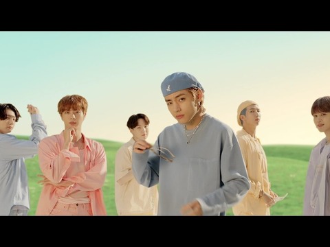
ダイナマイトビーティーエス
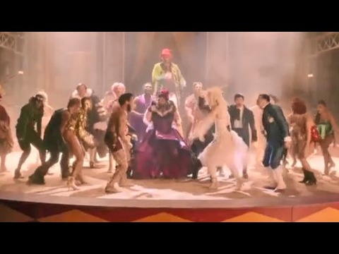
洋楽最新ヒット2020.08.20ディス・イズ・ミーグレイテスト・ショーマン・キャスト
洋楽人気動画2018.01.11グッド・ライフGイージー、ケラーニ
洋楽人気動画2017.01.27ホワット・ドゥ・ユー・ミーン?ジャスティン・ビーバー
洋楽人気動画2015.08.28ファイト・ソングレイチェル・プラッテン
洋楽人気動画2015.05.19ラヴ・ミー・ライク・ユー・ドゥエリー・ゴールディング
洋楽人気動画2015.01.22アップタウン・ファンクブルーノ・マーズ、マーク・ロンソン
洋楽人気動画2014.11.20ブレイク・フリーアリアナ・グランデ
洋楽人気動画2014.08.12ハッピーファレル・ウィリアムス
ポップス2014.01.08カウンティング・スターズワンリパブリック
ロック2013.05.31ア・サウザンド・イヤーズクリスティーナ・ペリー
洋楽人気動画2011.10.26ユー・レイズ・ミー・アップケルティック・ウーマン
洋楽人気動画2008.05.30ルーズ・ユアセルフエミネム
洋楽人気動画2008.02.21ドント・ノー・ホワイノラ・ジョーンズ
洋楽人気動画2008.02.15オンリー・タイムエンヤ
洋楽人気動画2007.10.03ミス・ア・シングエアロスミス
ロック2007.08.18タイム・トゥ・セイ・グッバイサラ・ブライトマン
洋楽人気動画2007.06.08シェイプ・オブ・マイ・ハートスティング
洋楽人気動画2007.03.18ウィ・アー・ザ・ワールド(U.S.A. フォー・アフリカ)マイケル・ジャクソン
洋楽人気動画2006.05.14ホテル・カリフォルニアイーグルス
ロック2005.07.06