TED日本語
TED Talks(英語 日本語字幕付き動画)
TED日本語 - ウィル・マーシャル: リアルタイムで地球の変化を撮影する極小衛星群
TED Talks
リアルタイムで地球の変化を撮影する極小衛星群
Tiny satellites that photograph the entire planet, every day
ウィル・マーシャル
Will Marshall
内容
衛星画像は、ほぼすべての街角の詳細な画像をネットで容易に利用可能にし、私たちの地球についての知識に革命をもたらしました。そして、Planet Labsのウィル・マーシャルは、小型化すれば、更に優れた画像を、より速く手に入れられると言います。10x10x30センチメートル程の小さな衛星なら一群で打ち上げられるので、地球全体の高解像度な衛星画像を毎日更新できるのです。


字幕
SCRIPT
Script
The Earth needs no introduction. It needs no introduction in part because the Apollo 17 astronauts, when they were hurtling around the moon in 1972, took this iconic image. It galvanized a whole generation of human beings to realize that we're on Spaceship Earth, fragile and finite as it is, and that we need to take care of it. But while this picture is beautiful, it's static, and the Earth is constantly changing. It's changing on days' time scales with human activity. And the satellite imagery we have of it today is old. Typically, years old. And that's important because you can't fix what you can't see. What we'd ideally want is images of the whole planet every day. So, what's standing in our way?
What's the problem? This is the problem: Satellites are big, expensive and they're slow. This one weighs three tons. It's six meters tall,four meters wide. It took up the entire fairing of a rocket just to launch it. One satellite,one rocket. It cost 855 million dollars. Satellites like these have done an amazing job at helping us to understand our planet. But if we want to understand it much more regularly, we need lots of satellites, and this model isn't scalable.
So me and my friends, we started Planet Labs to make satellites ultra-compact and small and highly capable. I'm going to show you what our satellite looks like: This is our satellite.
This is not a scale model, this is the real size. It's 10 by 10 by 30 centimeters, it weighs four kilograms, and we've stuffed the latest and greatest electronics and sensor systems into this little package so that even though this is really small, this can take pictures 10 times the resolution of the big satellite here, even though it weighs one thousandth of the mass. And we call this satellite "Dove" -- Thank you. (Applause) We call this satellite "Dove," and we call it "Dove" because satellites are typically named after birds, but normally birds of prey: like Eagle, Hawk, Swoop, Kill, I don't know, Kestrel, these sort of things. But ours have a humanitarian mission, so we wanted to call them Doves. And we haven't just built them, though. We've launched them. And not just one, but many.
It all started in our garage. Yes, we built our first satellite prototype in our garage. Now, this is pretty normal for a Silicon Valley company that we are, but we believe it's the first time for a space company. And that's not the only trick we learned from Silicon Valley. We rapidly prototype our satellites. We use "release early, release often" on our software. And we take a different risk approach. We take them outside and test them. We even put satellites in space just to test the satellites, and we've learned to manufacture our satellites at scale. We've used modern production techniques so we can build large numbers of them, I think for the first time. We call it agile aerospace, and that's what's enabled us to put so much capability into this little box.
Now, what has bonded our team over the years is the idea of democratizing access to satellite information. In fact, the founders of our company, Chris, Robbie and I, we met over 15 years ago at the United Nations when they were hosting a conference about exactly that question: How do you use satellites to help humanity? How do you use satellites to help people in developing countries or with climate change? And this is what has bonded us. Our entire team is passionate about using satellites to help humanity. You could say we're space geeks, but not only do we care about what's up there, we care about what's down here, too.
I'm going to show you a video from just four weeks ago of two of our satellites being launched from the International Space Station. This is not an animation, this is a video taken by the astronaut looking out of the window. It gives you a bit of a sense of scale of our two satellites. It's like some of the smallest satellites ever are being launched from the biggest satellite ever. And right at the end, the solar array glints in the sun. It's really cool. Wait for it. Boom! Yeah. It's the money shot. (Laughter)
So we didn't just launch two of them like this, we launched 28 of them. It's the largest constellation of Earth-imaging satellites in human history, and it's going to provide a completely radical new data set about our changing planet. But that's just the beginning. You see, we're going to launch more than 100 of these satellites like these over the course of the next year. It's going to be the largest constellation of satellites in human history. And this is what it's going to do: Acting in a single-orbit plane that stays fixed with respect to the sun, the Earth rotates underneath. They're all cameras pointed down, and they slowly scan across as the Earth rotates underneath. The Earth rotates every 24 hours, so we scan every point on the planet every 24 hours. It's a line scanner for the planet. We don't take a picture of anywhere on the planet every day, we take a picture of every single place on the planet every day. Even though we launched these just a couple of weeks ago, we've already got some initial imagery from the satellites and I'm going to show it publicly for the first time right now. This is the very first picture taken by our satellite. It happened to be over UC-Davis' campus in California when we turned the camera on. But what's even cooler is when we compare it to the previous latest image of that area, which was taken many months ago. And the image on the left is from our satellite, and we see buildings are being built. The general point is that we will be able to track urban growth as it happens around the whole world in all cities, every day.
Water as well.
Thank you. (Applause)
We'll be able to see the extent of all water bodies around the whole world every day and help water security. From water security to food security. We'll see crops as they grow in all the fields in every farmer's field around the planet every day. and help them to improve crop yield. This is a beautiful image that was taken just a few hours ago when the satellite was flying over Argentina. The general point is there are probably hundreds and thousands of applications of this data, I've mentioned a few, but there's others: deforestation, the ice caps melting. We can track all of these things, every tree on the planet every day. If you took the difference between today's image and yesterday's image, you'd see much of the world news -- you'd see floods and fires and earthquakes. And we have decided, therefore, that the best thing that we could do with our data is to ensure universal access to it. We want to ensure everyone can see it. Thank you. (Applause) We want to empower NGOs and companies and scientists and journalists to be able to answer the questions that they have about the planet. We want to enable the developer community to run their apps on our data. In short, we want to democratize access to information about our planet.
Which brings me back to this. You see, this will be an entirely new global data set. And we believe that together, we can help to take care of our Spaceship Earth. And what I would like to leave you with is the following question: If you had access to imagery of the whole planet every single day, what would you do with that data? What problems would you solve? What exploration would you do? Well, I invite you to come and explore with us.
Thank you very much.
(Applause)
地球の説明に前置きなど必要ありません その理由の一つは アポロ17号が 1972年に月の周りをまわっているとき 宇宙飛行士たちが撮った この象徴的な画像があるからです それは人類の全ての世代に 私たちが脆く限りある 宇宙船地球号に乗っていて 私たちはそれを守って いかなければならないと 気づかせました しかしこれは 美しく静的な画像ですが 実際の地球は常に変化しています 人間の活動の時間的スケールである 一日の単位で変化しています そして今日私達が目にする 衛星画像は最新のものではありません たいていは1年ほど昔のものです これは重要な点です 観察できないものは 直すことはできません 理想的なのは地球全体の映像が 毎日手に入ることです それを実現するのに 何が障害なのでしょう?
何が問題なのでしょう? これです 衛星は巨大で 高額で (開発に)時間が掛かるということです これは重さは3トン 高さ6メートル 幅4メートルです 打ち上げには ロケットのフェアリング全体を要しました 衛星1つにつき 1つのロケットです 約1千億円もの費用がかかりました こうした衛星たちは 私たちが地球を理解する上で 素晴らしい仕事をして来ました ですが私たちが地球を もっと定期的に観察するのであれば もっと多くの人工衛星が必要です そして 今のモデルでは 生産規模の拡大は不可能です
そこで私は友人とPlanet Labsを立ち上げ とてもコンパクトながら優秀な 超小型衛星を作ることにしました 私たちの衛星がどんなものか お見せしましょう これが私たちの衛星です
これは小型模型ではありません これが実際のサイズです 寸法10x10x30センチで 4キロの重さです これに最新で最先端の エレクトロニクスと センサーシステムを 詰め込みました これはとても小さいのですが 大きな衛星に比べ 10倍の解像度の画像を撮ることができます 重さはその千分の一 であるにも関わらずです 私たちはこの衛星を「ダヴ(鳩)」と呼び ― ありがとうございます (拍手) 私たちはこの衛星を「ダヴ」と呼びます なぜなら衛星には 通常 鳥にちなんだ名前が付けられるからです 普通は猛禽類にちなんだ名前 イーグル、ホーク、スゥープ、キル ― これは意味不明ですが ― ケストレルなどと名付けられます しかし これには 人道的な使命があるので 「ダブ(鳩)」と名づけました 私たちはこれらの衛星を 作っただけでなく 打ち上げました それも1つでなく 多くをです
全ては私たちのガレージから 始まりました 私たちは最初の衛星の試作機を ガレージで作りました 私たちのようなシリコンバレーの 会社にとっては極めて普通の事ですが 宇宙開発会社としては 初めてだと信じています 私たちがシリコンバレーから 学んだテクニックはこれだけではなく 私たちは衛星のプロトタイプを素早く作成し ― ソフトウェアを「早期に 頻繁に リリース」しています 私たちのリスク対策は独特です 外部にそれらを持ち出し テストします ただ テストする目的のために 衛星を宇宙空間へ打ち上げます そして私たちは衛星を大量に 製造する方法を学びました 現代的な生産技術を使用し 大量生産を可能にしました ― 多分これも初の事でしょう 私たちはこれを 「機敏な航空宇宙産業」と称しています こうやって多くの機能を 小さな箱に詰め込むことができました
長年 私たちの チームを結束させてきたのは 衛星情報へのアクセスの民主化 というアイデアです 創設者達 ― クリス、ロビーと私は 15年以上前に国連で出会いました 彼らはまさにこの問いに関する 会議を主催していたのです 「人類のために衛星を使う方法は?」 「発展途上国の人々や 気候変動の観測に 衛星を役立てる方法は?」 これらが私たちを一つにしたのです 私たちのチームは人道的な衛星の活用に 熱心に取り組んでいます 私たちは宇宙オタク その通りです でも私たちは宇宙だけを 見ているのではありません 地球上のことにも関心を抱いています
これからわずか4週間前に 私たちの2つの衛星が 国際宇宙ステーションから 発射された映像をお見せしましょう これはアニメーションではなく これは宇宙飛行士が 窓を通して撮影したビデオです 我々の2つの衛星の大きさが分かるでしょう それは史上最大の衛星から 史上最小の衛星が 発射されるといった感じです そして最後に太陽光で 太陽電池パネルがきらめきます 本当にクールです 見ていて下さい ― ブーム!イェイ! 決定的な瞬間です (笑)
我々はこの2つだけだけでは無く― 28機を打ち上げました 人類史上最大の 地球イメージング衛星の一群です これらは変化し続ける地球に関する 根本的に新しい種類の データを提供するのです これはほんの始まりです 我々はこれらの衛星100機以上を 来年中に打ち上げる予定です それは人間の歴史の中で最大の 衛星群となるでしょう そして衛星たちは 太陽と一定の角度の軌道面を周回し その下では地球が回転しています すべてのカメラは下に地球を向き 地球の回転に伴い ゆっくりとスキャンしていきます 地球は24時間ごとに回転し 24時間ごとに地球上の 全てのポイントをスキャンします 地球のラインスキャナーのようです 地球上のどこかを適当に 毎日撮るというわけではなく 地球上のあらゆる場所を 毎日撮影するのです これらは数週間前に打ち上げたばかりですが 我々はすでに人工衛星から 初期画像を手に入れました 今初めて公開します これは私たちの衛星が とらえた最初の写真です 電源を入れた時 偶然にも カリフォルニア州立大学 デービス校の キャンパス上空にいました もっと凄いことに これを同地点の何ヶ月も前の 他の最新衛星画像と比較すると 左の画像が我々の衛星写真で 建物が建設されているのが見えます つまり私たちは 全世界の全ての都市で 成長が起こる様子を 毎日追跡することができます
水の状態も同様です
ありがとうございます (拍手)
毎日 世界中の水資源の様子を 確認出来るようになることで 水資源の保全に役立ちます 水資源の保全 そして食糧の保全についても 毎日 世界中のあらゆる農場で 作物が育つ様子を追うことで 収穫量の改善に役立てることもできます これは ほんの数時間前に アルゼンチンの上空にいた 衛星が撮影した美しい画像です 要するに ― このデータには 何百、何千という応用法があり その一部をご紹介しましたが 他にも 森林伐採や溶けゆく氷冠 それら全て 地球上の木一本 一本の姿を 日々追跡することができます 今日と昨日の画像を比べると 洪水、森林火災や地震といった 世界のニュースの多くを 確認することができるでしょう そこで私たちは このようなデータを 最大限に活用する方法として 誰もがデータにアクセスできるように するという決断をしました 皆さんに見て頂きたいのです ありがとうございます (拍手) 私たちはNGO、企業や科学者 そしてジャーナリストたちが 地球に関する疑問への答えを見つける 手助けをしたいのです 開発者たちが このデータで自分のアプリを 走らせて欲しいと願っています つまり 私たちの地球に関する 情報へのアクセスを民主化したいのです
そして最初の問いに戻ります これは全く新しい 地球規模のデータとなります そして私たちは 皆が協力すれば この宇宙船地球号を大切にする事が できると信じています そして皆さんにはこのことを 考えて頂きたいのです もし地球全体の画像が 毎日 手に入るとしたら そのデータで何をしますか? どんな問題を解決したいですか? どんな探査をしたいと思いますか? 私たちと共にそれを探りましょう
ありがとうございました
(拍手)
品詞分類
- 主語
- 動詞
- 助動詞
- 準動詞
- 関係詞等
TED 日本語
TED Talks
関連動画

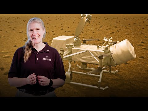
謎に包まれた土星の衛星タイタンを調べて生命の起源に関して何がわかるかエリザベス・ジビ・タートル
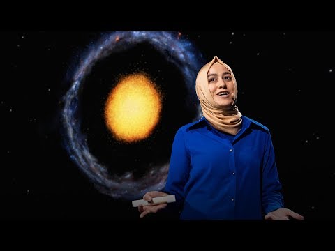
2020.09.17宇宙に関する理解に疑問を抱かせる珍しい銀河ブーチン・ムトゥル・パクディル
2018.09.18宇宙人はどこにいるのでしょう?スティーヴン・ウェッブ
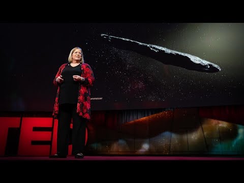
2018.08.16他の恒星系からの初の訪問者オウムアムアカレン・J・ミーチ
2018.07.19地球上で最も火星によく似た場所アルマンド・アズア・ブストス
2017.10.05あなたは皆既日食を是非体験すべきであるデイヴィッド・バロン
2017.08.10ブラックホールの写真を撮影するケイティ・バウマン
2017.04.28地球を周回している宇宙ゴミを片付けましょうナタリー・パネク
2017.01.05地球外生命を宿しているかもしれない1つの惑星と3つの衛星ジェームズ・グリーン
2016.09.07惑星が生命を育むために必要なものデイヴ・ブレイン
2016.09.04火星に移住する子供達が生き抜く方法スティーブン・ペトラネック
2016.05.05宇宙でもっとも神秘的な星タベサ・ボヤジアン
2016.04.29重力波発見が意味することアラン・アダムス
2016.03.10他の惑星の生命を見つけ出す方法アオマワ・シールズ
2016.01.28物理学は終焉に達したのか?ハリー・クリフ
2016.01.26火星は予備の地球ではないルシアン・ウォーコウィッチ
2016.01.14
洋楽 おすすめ
RECOMMENDS
洋楽歌詞
ステイザ・キッド・ラロイ、ジャスティン・ビーバー
洋楽最新ヒット2021.08.20スピーチレス~心の声ナオミ・スコット
洋楽最新ヒット2019.05.23シェイプ・オブ・ユーエド・シーラン
洋楽人気動画2017.01.30フェイデッドアラン・ウォーカー
洋楽人気動画2015.12.03ウェイティング・フォー・ラヴアヴィーチー
洋楽人気動画2015.06.26シー・ユー・アゲインウィズ・カリファ
洋楽人気動画2015.04.06シュガーマルーン5
洋楽人気動画2015.01.14シェイク・イット・オフテイラー・スウィフト
ポップス2014.08.18オール・アバウト・ザット・ベースメーガン・トレイナー
ポップス2014.06.11ストーリー・オブ・マイ・ライフワン・ダイレクション
洋楽人気動画2013.11.03コール・ミー・メイビーカーリー・レイ・ジェプセン
洋楽人気動画2012.03.01美しき生命コールドプレイ
洋楽人気動画2008.08.04バッド・デイ~ついてない日の応援歌ダニエル・パウター
洋楽人気動画2008.05.14サウザンド・マイルズヴァネッサ・カールトン
洋楽人気動画2008.02.19イッツ・マイ・ライフボン・ジョヴィ
ロック2007.10.11アイ・ウォント・イット・ザット・ウェイバックストリート・ボーイズ
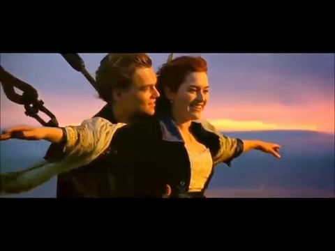
洋楽人気動画2007.09.14マイ・ハート・ウィル・ゴー・オンセリーヌ・ディオン
洋楽人気動画2007.07.12ヒーローマライア・キャリー
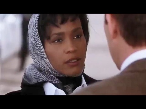
洋楽人気動画2007.03.21オールウェイズ・ラヴ・ユーホイットニー・ヒューストン
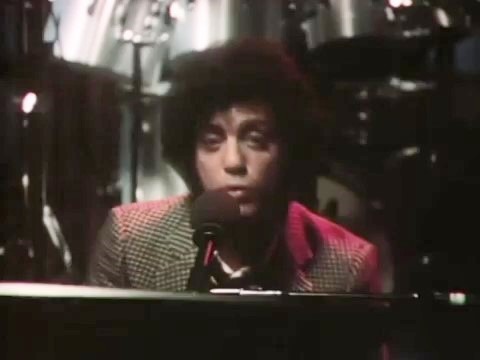
洋楽人気動画2007.02.19オネスティビリー・ジョエル
洋楽人気動画2005.09.16